
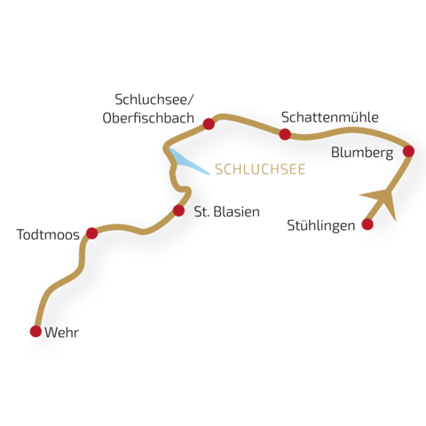
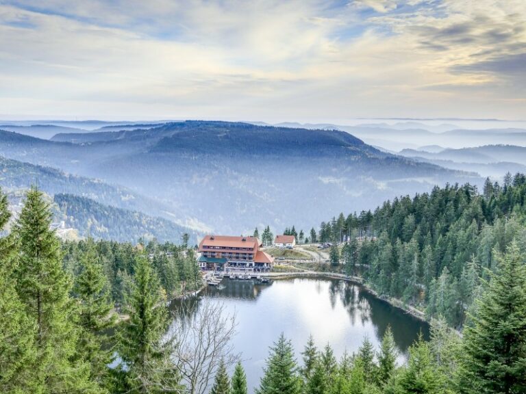
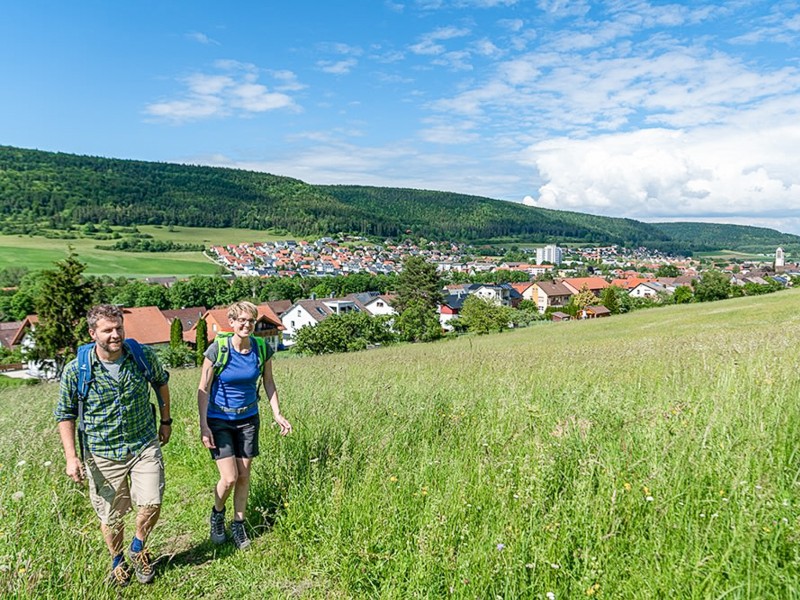
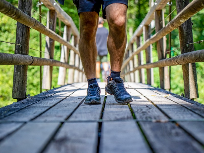
Deep gorges & rugged landscapes
One of the most popular long-distance hiking trails of Germany. The scenic trail offers hikers beautiful an rugged landscape whil pasing through deep gorges, dense forests and picturesque villages.
Distance about 19 km | 510 m ascent | 270 m descent
On the very first day, you’ll get an idea of why the Schluchtensteig bears its name. The ascents should not be underestimated but are rewarded with impressive views. With a bit of luck, the historic Sauschwänzle Railway crosses your path on the first part of the stage. Later, you’ll traverse narrow, root-filled paths through the primeval-like Wutach Gorge towards Blumberg.
Distance about 20 km | 340 m ascent | 370 m descent
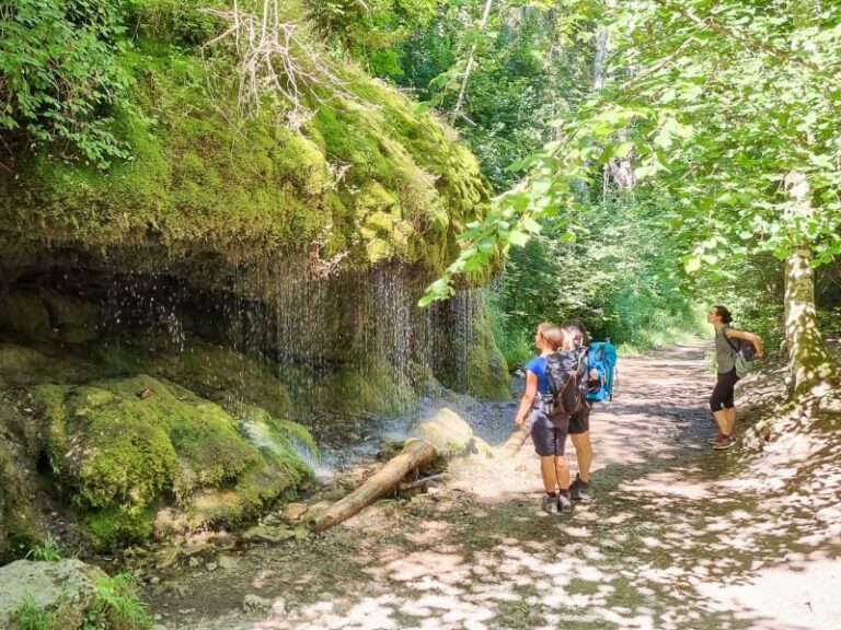
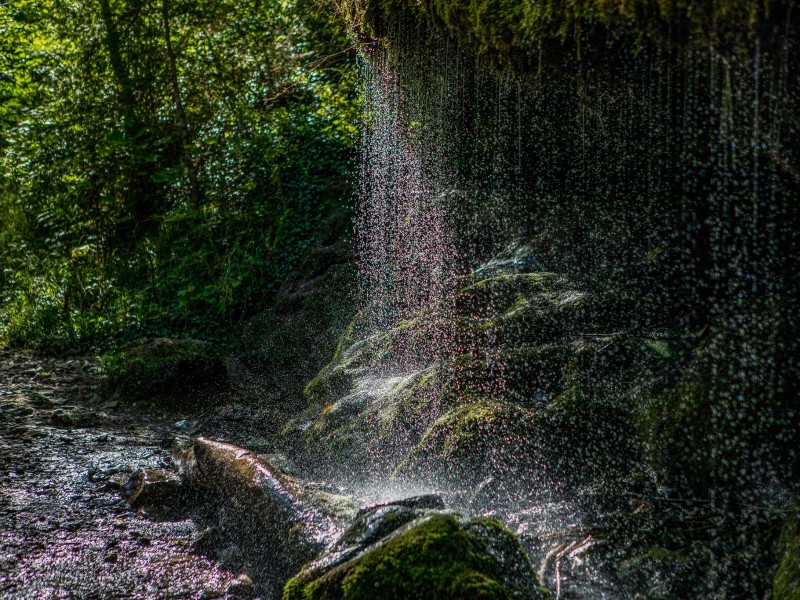
Today you’ll delve deep into the world of the Black Forest gorges. Between steep, rugged cliffs, the wild Wutach River carves its way through one of the oldest nature reserves in Baden-Württemberg. The path always follows along the rushing river, waterfalls splashing, lush greenery surrounding you everywhere. At the end of the stage, a hiking bus will take you on a short ride from Schattenmühle to Löffingen.
Distance about 18 km | 600 m ascent | 249 m descent
In the morning, you’ll take the bus back to Schattenmühle to continue your hike from there. Passing by the Räuberschlössle (robber’s castle) and the Stallegger wooden bridge, the path leads you in a constant up and down out of the gorge towards Lenzkirch. Particularly idyllic spots can be found at the confluences of Rötenbach and Haslach. In Lenzkirch, taking a short break pays off because from here, you’ll climb steeply up to Fischbach.
Distance about 21 km | 410 m ascent | 670 m descent
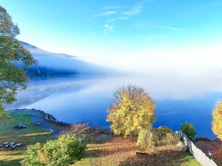
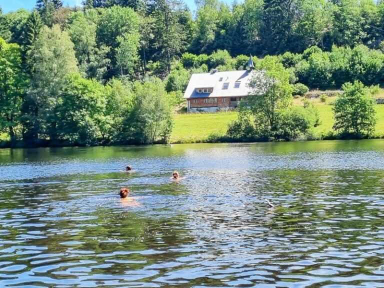
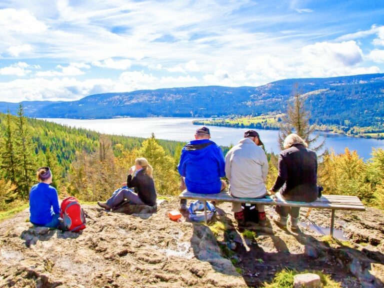
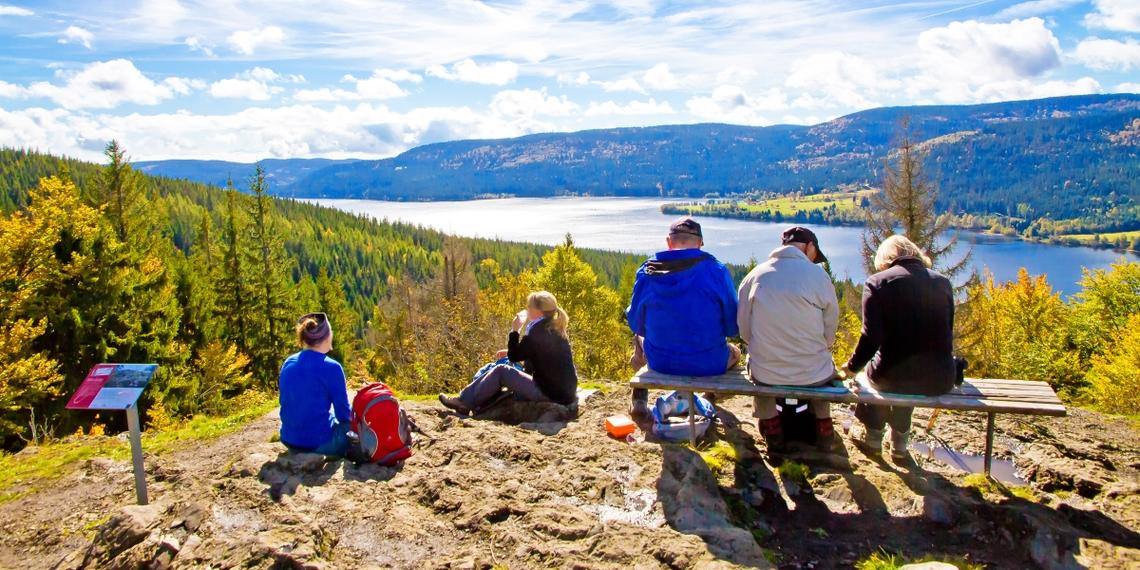
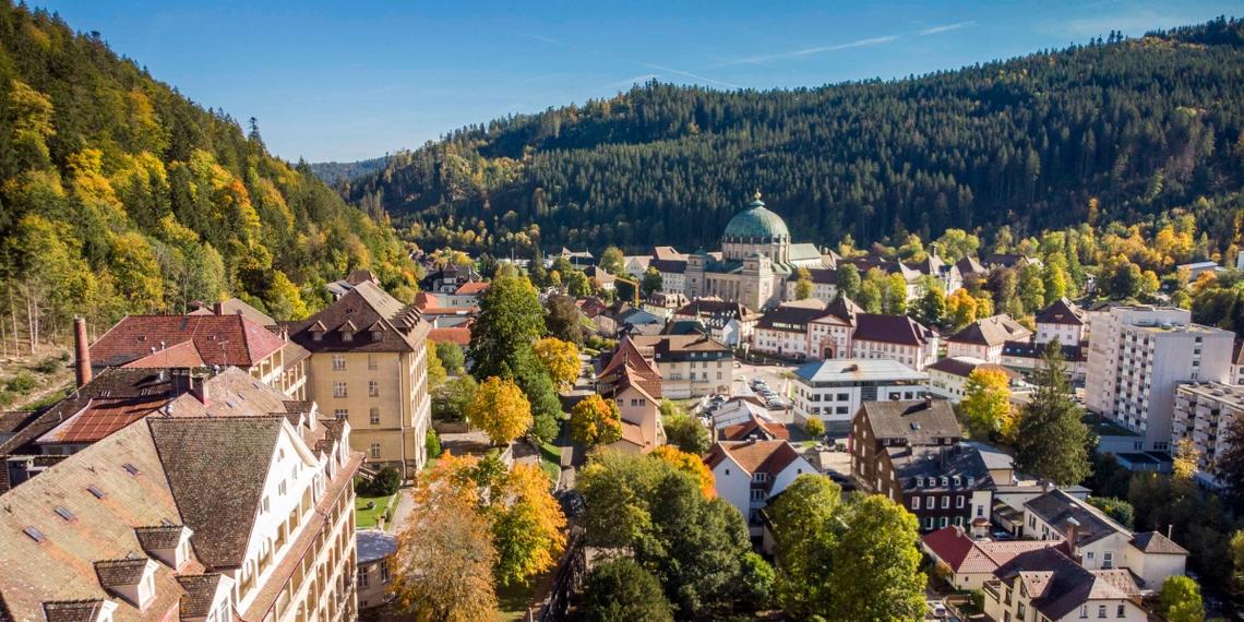
As soon as you set off on your morning hike, one of the most beautiful views of the tour awaits you: the vista from Bildstein down to Lake Schluchsee, and on clear days, even to the peaks of the Alps. During a stop at the Unterkrummenhof, you can observe the sparkling waters of the enormous Schluchsee. Continuing on diverse forest paths, you’ll head towards St. Blasien. Here, be sure to take a look inside the cathedral with its impressive dome.
Distance about 19 km | 540 m ascent | 500 m descent
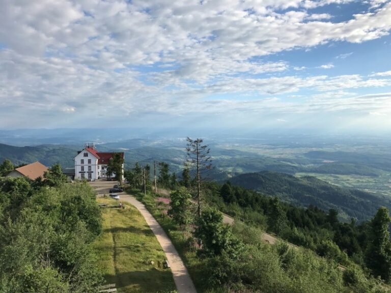
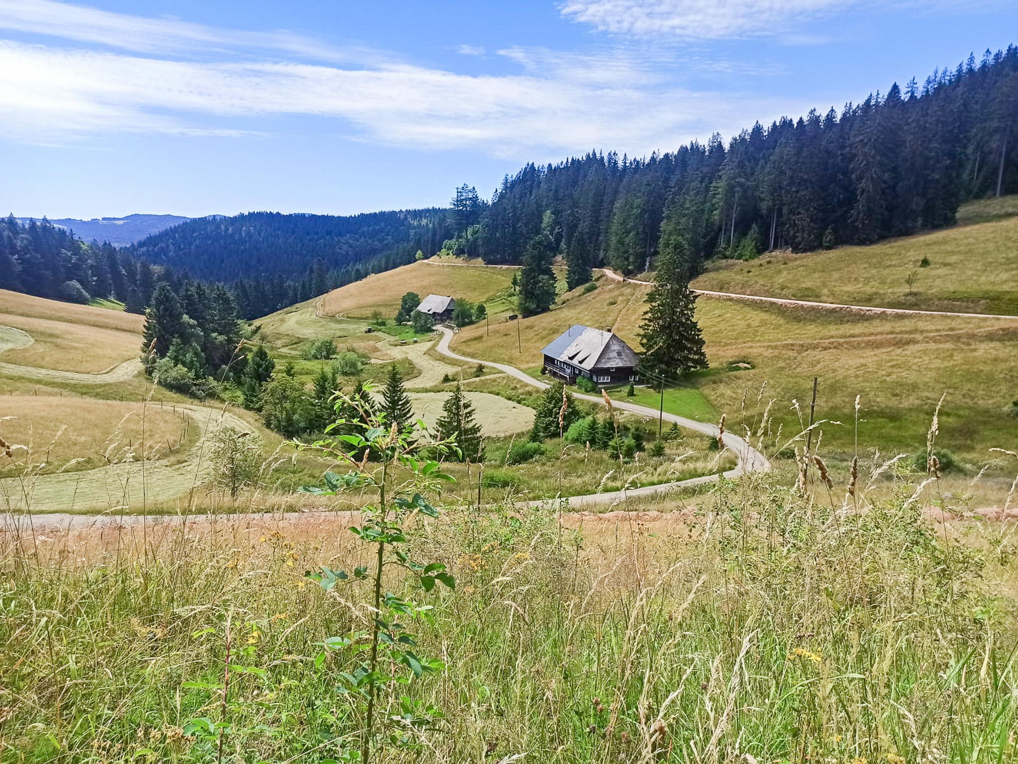
From the starting point in St. Blasien, you’ll initially ascend. The climb is rewarding. Instead of looking into deep gorges today, you’ll enjoy distant views from numerous viewpoints. Passing by the Klosterweiher (monastery pond) and Dachsberg, you’ll ascend to the Ibacher Heights. At the top of the observation tower on Lehenkopf, your gaze sweeps far across the Black Forest. From Horbacher Heide, on clear days, you can see all the way to the Swiss Jura and the Alps. A panoramic board explains the visible peaks of the Alpine range. At the end of the stage, the trail lives up to its name once again: it descends into the Hohwehraschlucht (Hohwehra Gorge) to the gingerbread village of Todtmoos.
Distance about 23 km | 410 m ascent | 870 m descent
On beautiful forest trails, the final stage leads you to your destination in Wehr. Along the way, you’ll hike on narrow paths with steep slopes. A short additional ascent to the Mettlerhütte is worth it. The small hut is not staffed, but there is a fountain in front of it where you can refill your water supplies and enjoy the beautiful view. After passing the Wehra Reservoir, the trail continues leisurely to the final destination of Wehr.
individual hiking tour
- Enjoy the quiet idyll of the Black Forest
- Hike off the main route on peaceful trails
- Marvel at stunning panoramic views from the two highest peaks of the Black Forest
Difficulty:
individual hiking tour
Difficulty:
- Enjoy the quiet idyll of the Black Forest
- Hike off the main route on peaceful trails
- Marvel at stunning panoramic views from the two highest peaks of the Black Forest
individual hiking tour
- the highest and most beautiful peak in the Black Forest
- a Black Forest classic: Lake Feldsee
- charming landscapes of the Markgräflerland region
Difficulty:
individual hiking tour
Difficulty:
- the highest and most beautiful peak in the Black Forest
- a Black Forest classic: Lake Feldsee
- charming landscapes of the Markgräflerland region
individual hiking tour
- the highest and the most beautiful peak in the Black Forest
- a Black Forest classic: Lake Titisee
- charming landscapes of the Markgräflerland region
Difficulty:
individual hiking tour
Difficulty:
- the highest and the most beautiful peak in the Black Forest
- a Black Forest classic: Lake Titisee
- charming landscapes of the Markgräflerland region
individual hiking tour
- beautiful, unspoiled moorland plateaus
- a Black Forest classic: Lake Mummelsee
- the fairytale high moor of Kaltenbronn
Difficulty:
individual hiking tour
Difficulty:
- beautiful, unspoiled moorland plateaus
- a Black Forest classic: Lake Mummelsee
- the fairytale high moor of Kaltenbronn
individual hiking tour
- cross the entire Black Forest from north to south
- experience breathtaking panoramic views over the Black Forest and the Rhine Valley
- discover the highest Black Forest peaks
Difficulty:
individual hiking tour
Difficulty:
- cross the entire Black Forest from north to south
- experience breathtaking panoramic views over the Black Forest and the Rhine Valley
- discover the highest Black Forest peaks
individual hiking tour
- enjoy the peaceful idyll of the Black Forest
- hike off the main route on quiet trails
- take in breathtaking panoramic views from the two highest peaks of the Black Forest
Difficulty:
individual hiking tour
Difficulty:
- enjoy the peaceful idyll of the Black Forest
- hike off the main route on quiet trails
- take in breathtaking panoramic views from the two highest peaks of the Black Forest
individual hiking tour
- the highest and most beautiful peak in the Black Forest
- a Black Forest classic: Lake Feldsee
- charming landscapes of the Markgräflerland region
Difficulty:
individual hiking tour
Difficulty:
- the highest and most beautiful peak in the Black Forest
- a Black Forest classic: Lake Feldsee
- charming landscapes of the Markgräflerland region
individual hiking tour
- the highest and the most beautiful peak in the Black Forest
- a Black Forest classic: Lake Titisee
- charming landscapes of the Markgräflerland region
Difficulty:
individual hiking tour
Difficulty:
- the highest and the most beautiful peak in the Black Forest
- a Black Forest classic: Lake Titisee
- charming landscapes of the Markgräflerland region
individual hiking tour
- beautiful, unspoiled moorland plateaus
- a Black Forest classic: Lake Mummelsee
- the fairytale high moor of Kaltenbronn
Difficulty:
individual hiking tour
Difficulty:
- beautiful, unspoiled moorland plateaus
- a Black Forest classic: Lake Mummelsee
- the fairytale high moor of Kaltenbronn
individual hiking tour
- cross the entire Black Forest from north to south
- experience breathtaking panoramic views over the Black Forest and the Rhine Valley
- discover the highest Black Forest peaks
Difficulty:
individual hiking tour
Difficulty:
- cross the entire Black Forest from north to south
- experience breathtaking panoramic views over the Black Forest and the Rhine Valley
- discover the highest Black Forest peaks
Individuelle Wanderreise
- stille Schwarzwald-Idylle genießen
- wandern abseits der Hauptroute auf ruhigen Strecken
- herrliche Panoramasichten von den zwei höchsten Schwarzwald-Gipfeln
Difficulty:
Individuelle Wanderreise
Difficulty:
- stille Schwarzwald-Idylle genießen
- wandern abseits der Hauptroute auf ruhigen Strecken
- herrliche Panoramasichten von den zwei höchsten Schwarzwald-Gipfeln
Individuelle Wanderreise
- der höchste und der schönste Gipfel im Schwarzwald
- typisch Schwarzwald: der Feldsee
- liebliche Landschaft im Markgräflerland
Difficulty:
Individuelle Wanderreise
Difficulty:
- der höchste und der schönste Gipfel im Schwarzwald
- typisch Schwarzwald: der Feldsee
- liebliche Landschaft im Markgräflerland
Individuelle Wanderreise
- der höchste und der schönste Gipfel im Schwarzwald
- typisch Schwarzwald: Titisee
- liebliche Landschaft im Markgräflerland
Difficulty:
Individuelle Wanderreise
Difficulty:
- der höchste und der schönste Gipfel im Schwarzwald
- typisch Schwarzwald: Titisee
- liebliche Landschaft im Markgräflerland
Individuelle Wanderreise
- wunderschöne ursprüngliche Grindenlandschaften
- typisch Schwarzwald: der Mummelsee
- märchenhaftes Hochmoor Kaltenbronn
Difficulty:
Individuelle Wanderreise
Difficulty:
- wunderschöne ursprüngliche Grindenlandschaften
- typisch Schwarzwald: der Mummelsee
- märchenhaftes Hochmoor Kaltenbronn
Individuelle Wanderreise
- den Schwarzwald komplett von Nord nach Süd durchqueren
- faszinierende Weitsichten über Schwarzwald und Rheintal
- Schwarzwald-Gipfel-Tour
Difficulty:
Individuelle Wanderreise
Difficulty:
- den Schwarzwald komplett von Nord nach Süd durchqueren
- faszinierende Weitsichten über Schwarzwald und Rheintal
- Schwarzwald-Gipfel-Tour
Individuelle Tourenradreise
- fast ohne Höhenmeter durch den Südschwarzwald radeln
- dem Fluss der Wutach und des Hochrheins folgen
- durch die wunderschönen Altstädte von Waldshut, Bad Säckingen, Basel und Freiburg flanieren
Difficulty:
Individuelle Tourenradreise
Difficulty:
- fast ohne Höhenmeter durch den Südschwarzwald radeln
- dem Fluss der Wutach und des Hochrheins folgen
- durch die wunderschönen Altstädte von Waldshut, Bad Säckingen, Basel und Freiburg flanieren
individual hiking tour
- deep gorges & blooming meadows
- “Pearls of the Black Forest”: Lake Schluchsee, St. Blasien Cathedral
- the scenic diversity of the Southern Black Forest Nature Park
Difficulty:
individual hiking tour
Difficulty:
- deep gorges & blooming meadows
- “Pearls of the Black Forest”: Lake Schluchsee, St. Blasien Cathedral
- the scenic diversity of the Southern Black Forest Nature Park
individual hiking tour
- start of the tour at Lake Schluchsee, the largest lake in the Black Forest
- cultural landmark: St. Blasien Cathedral
- through primeval forest and the Wehraschlucht gorge
Difficulty:
individual hiking tour
Difficulty:
- start of the tour at Lake Schluchsee, the largest lake in the Black Forest
- cultural landmark: St. Blasien Cathedral
- through primeval forest and the Wehraschlucht gorge
individual hiking tour
- primeval-like landscape in the Wutach cliffs
- steep rocks, babbling streams, blooming meadows
- through the impressive Wutach Gorge
Difficulty:
individual hiking tour
Difficulty:
- primeval-like landscape in the Wutach cliffs
- steep rocks, babbling streams, blooming meadows
- through the impressive Wutach Gorge
individual hiking tour
- deep gorges & blooming meadows
- “Pearls of the Black Forest”: Lake Schluchsee, St. Blasien Cathedral
- the scenic diversity of the Southern Black Forest Nature Park
Difficulty:
individual hiking tour
Difficulty:
- deep gorges & blooming meadows
- “Pearls of the Black Forest”: Lake Schluchsee, St. Blasien Cathedral
- the scenic diversity of the Southern Black Forest Nature Park
individual hiking tour
- deep gorges & blooming meadows
- “Pearls of the Black Forest”: Lake Schluchsee, St. Blasien Cathedral
- the scenic diversity of the Southern Black Forest Nature Park
Difficulty:
individual hiking tour
Difficulty:
- deep gorges & blooming meadows
- “Pearls of the Black Forest”: Lake Schluchsee, St. Blasien Cathedral
- the scenic diversity of the Southern Black Forest Nature Park
individual hiking tour
- start of the tour at Lake Schluchsee, the largest lake in the Black Forest
- cultural landmark: St. Blasien Cathedral
- through primeval forest and the Wehraschlucht gorge
Difficulty:
individual hiking tour
Difficulty:
- start of the tour at Lake Schluchsee, the largest lake in the Black Forest
- cultural landmark: St. Blasien Cathedral
- through primeval forest and the Wehraschlucht gorge
individual hiking tour
- primeval-like landscape in the Wutach cliffs
- steep rocks, babbling streams, blooming meadows
- through the impressive Wutach Gorge
Difficulty:
individual hiking tour
Difficulty:
- primeval-like landscape in the Wutach cliffs
- steep rocks, babbling streams, blooming meadows
- through the impressive Wutach Gorge
individual hiking tour
- fascinating canyons and ravines
- Lake Schluchsee and the Cathedral of St. Blasien
- the diverse landscapes of the Black Forest Nature Park
Difficulty:
individual hiking tour
Difficulty:
- fascinating canyons and ravines
- Lake Schluchsee and the Cathedral of St. Blasien
- the diverse landscapes of the Black Forest Nature Park
Individuelle Wanderreise
- tiefe Schluchten & blühende Weiden
- „Perlen des Schwarzwalds“: Schluchsee, Dom von St. Blasien
- landschaftliche Vielfalt des Naturpark Südschwarzwald
Difficulty:
Individuelle Wanderreise
Difficulty:
- tiefe Schluchten & blühende Weiden
- „Perlen des Schwarzwalds“: Schluchsee, Dom von St. Blasien
- landschaftliche Vielfalt des Naturpark Südschwarzwald
Individuelle Wanderreise
- Beginn der Tour am größten Schwarzwald-See, dem Schluchsee
- Kultur-Denkmal: Dom von St. Blasien
- durch Bannwald und die Wehraschlucht
Difficulty:
Individuelle Wanderreise
Difficulty:
- Beginn der Tour am größten Schwarzwald-See, dem Schluchsee
- Kultur-Denkmal: Dom von St. Blasien
- durch Bannwald und die Wehraschlucht
Individuelle Wanderreise
- urwaldartige Landschaft in den Wutachflühen
- steile Felsen, plätscherndes Wasser, blühende Wiesen
- durch die beeindruckende Wutachschlucht
Difficulty:
Individuelle Wanderreise
Difficulty:
- urwaldartige Landschaft in den Wutachflühen
- steile Felsen, plätscherndes Wasser, blühende Wiesen
- durch die beeindruckende Wutachschlucht
Individuelle Wanderreise
- Faszinierende Schluchten und Klammen
- Schluchsee und der Dom von St. Blasien
- landschaftliche Vielfalt des Naturpark Südschwarzwald
Difficulty:
Individuelle Wanderreise
Difficulty:
- Faszinierende Schluchten und Klammen
- Schluchsee und der Dom von St. Blasien
- landschaftliche Vielfalt des Naturpark Südschwarzwald
Individuelle Wanderreise
- stille Schwarzwald-Idylle genießen
- wandern abseits der Hauptroute auf ruhigen Strecken
- herrliche Panoramasichten von den zwei höchsten Schwarzwald-Gipfeln
Difficulty:
Individuelle Wanderreise
Difficulty:
- stille Schwarzwald-Idylle genießen
- wandern abseits der Hauptroute auf ruhigen Strecken
- herrliche Panoramasichten von den zwei höchsten Schwarzwald-Gipfeln
Individuelle Wanderreise
- der höchste und der schönste Gipfel im Schwarzwald
- typisch Schwarzwald: der Feldsee
- liebliche Landschaft im Markgräflerland
Difficulty:
Individuelle Wanderreise
Difficulty:
- der höchste und der schönste Gipfel im Schwarzwald
- typisch Schwarzwald: der Feldsee
- liebliche Landschaft im Markgräflerland
Individuelle Wanderreise
- der höchste und der schönste Gipfel im Schwarzwald
- typisch Schwarzwald: Titisee
- liebliche Landschaft im Markgräflerland
Difficulty:
Individuelle Wanderreise
Difficulty:
- der höchste und der schönste Gipfel im Schwarzwald
- typisch Schwarzwald: Titisee
- liebliche Landschaft im Markgräflerland
Individuelle Wanderreise
- wunderschöne ursprüngliche Grindenlandschaften
- typisch Schwarzwald: der Mummelsee
- märchenhaftes Hochmoor Kaltenbronn
Difficulty:
Individuelle Wanderreise
Difficulty:
- wunderschöne ursprüngliche Grindenlandschaften
- typisch Schwarzwald: der Mummelsee
- märchenhaftes Hochmoor Kaltenbronn
Individuelle Wanderreise
- den Schwarzwald komplett von Nord nach Süd durchqueren
- faszinierende Weitsichten über Schwarzwald und Rheintal
- Schwarzwald-Gipfel-Tour
Difficulty:
Individuelle Wanderreise
Difficulty:
- den Schwarzwald komplett von Nord nach Süd durchqueren
- faszinierende Weitsichten über Schwarzwald und Rheintal
- Schwarzwald-Gipfel-Tour
Individuelle Wanderreise
- tiefe Schluchten & blühende Weiden
- „Perlen des Schwarzwalds“: Schluchsee, Dom von St. Blasien
- landschaftliche Vielfalt des Naturpark Südschwarzwald
Difficulty:
Individuelle Wanderreise
Difficulty:
- tiefe Schluchten & blühende Weiden
- „Perlen des Schwarzwalds“: Schluchsee, Dom von St. Blasien
- landschaftliche Vielfalt des Naturpark Südschwarzwald
Individuelle Wanderreise
- Beginn der Tour am größten Schwarzwald-See, dem Schluchsee
- Kultur-Denkmal: Dom von St. Blasien
- durch Bannwald und die Wehraschlucht
Difficulty:
Individuelle Wanderreise
Difficulty:
- Beginn der Tour am größten Schwarzwald-See, dem Schluchsee
- Kultur-Denkmal: Dom von St. Blasien
- durch Bannwald und die Wehraschlucht
Individuelle Wanderreise
- urwaldartige Landschaft in den Wutachflühen
- steile Felsen, plätscherndes Wasser, blühende Wiesen
- durch die beeindruckende Wutachschlucht
Difficulty:
Individuelle Wanderreise
Difficulty:
- urwaldartige Landschaft in den Wutachflühen
- steile Felsen, plätscherndes Wasser, blühende Wiesen
- durch die beeindruckende Wutachschlucht
Individuelle Wanderreise
- tiefe Schluchten & blühende Weiden
- „Perlen des Schwarzwalds“: Schluchsee, Dom von St. Blasien
- landschaftliche Vielfalt des Naturpark Südschwarzwald
Difficulty:
Individuelle Wanderreise
Difficulty:
- tiefe Schluchten & blühende Weiden
- „Perlen des Schwarzwalds“: Schluchsee, Dom von St. Blasien
- landschaftliche Vielfalt des Naturpark Südschwarzwald
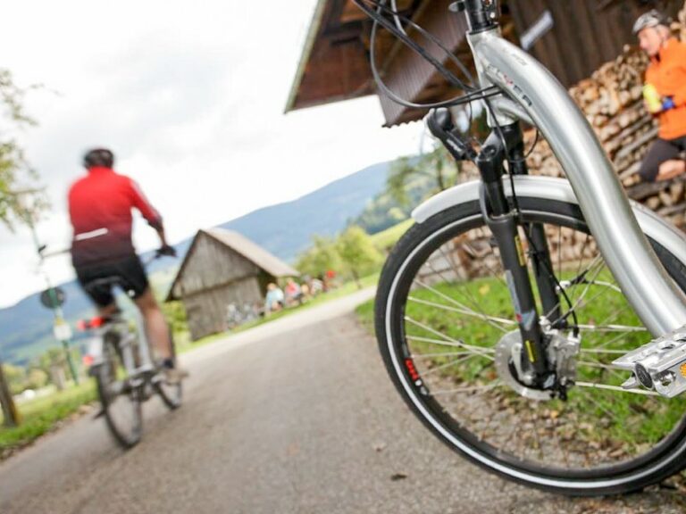
individual bicycle roundtrip
- bike through the Southern Black Forest with hardly any elevation gain
- follow the Wutach River and River Rhine
- stroll through the beautiful old towns of Waldshut, Bad Säckingen, Basel and Freiburg
Difficulty:
individual bicycle roundtrip
Difficulty:
- bike through the Southern Black Forest with hardly any elevation gain
- follow the Wutach River and River Rhine
- stroll through the beautiful old towns of Waldshut, Bad Säckingen, Basel and Freiburg
Who is the Schluchtensteig-Trail suitable for?
This hiking tour on the Schluchtensteig trail is ideal for couples, small groups and individual travellers.
This trip is not suitable for people with limited mobility.
Kids
Requirements & difficulty
Which level does the trail have?
According to our definitions, it’s a level 3 trail:
3 Points = moderate & sporty | walking time: 4-7 hours | ascent: 400-600 meters
You have a passion for hiking and frequently explore hilly terrain. You don’t mind more challenging hikes with longer distances and steeper climbs.
Characteristics of the trail
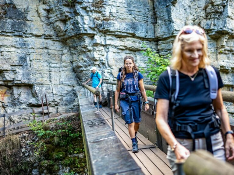
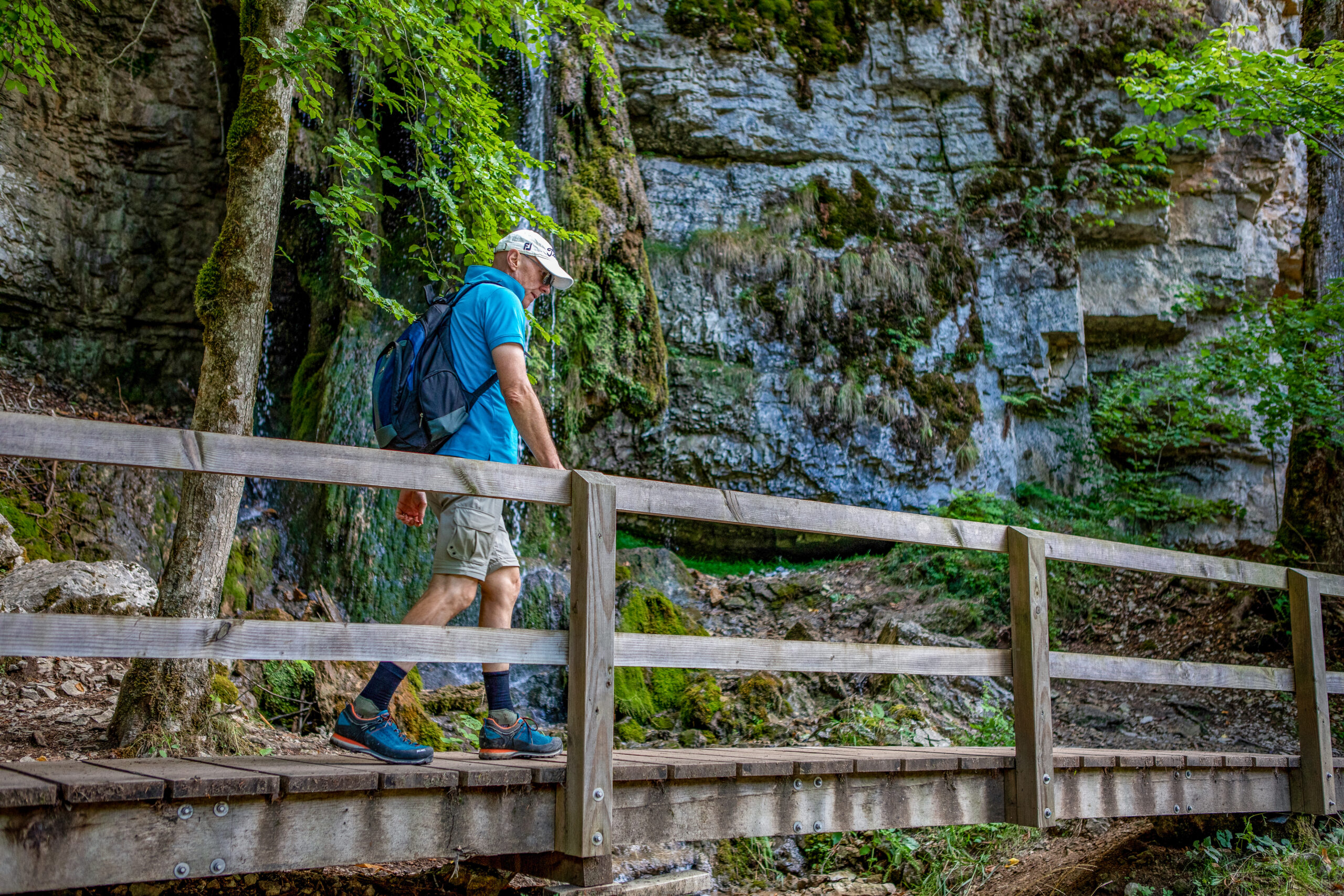
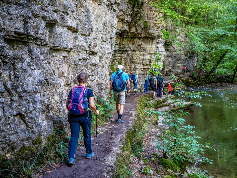
Narrow paths and rugged trails in the canyons, as well as quiet forest paths in the Black Forest ridges, characterize the Schluchtensteig trail. Especially in the Wutach canyon, paths lead through deep gorges, known for their mostly short and steep sections as well as ladders – you should be sure-footed and free from giddiness.
- The first stage from Stühlingen to Blumberg is also good for those who are not afraid of heights.
- Right at the start of the second stage, an 8 meter high and very steep ladder leads down into the small Schleifenbach gorge to the waterfalls there. However, this section can also be bypassed.
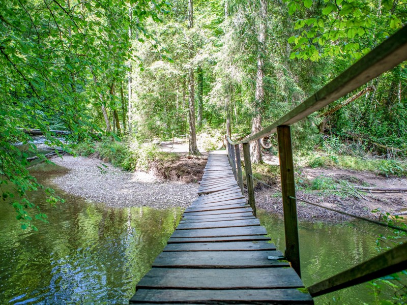
- In the Haslachschlucht on the 3rd stage you go over a footbridge that is suspended from the rock. The footbridge is wide enough and very well secured with railings that even hikers who are afraid of heights can pass it safely.
- The 4th and 5th stages are no problem for hikers who are not afraid of heights.
- On the 6th stage in the Wehraschlucht, the trail at Hirschfelsen runs well secured (wire rope on the mountain side) around a rock face. The path is wide enough so that you don’t have to look down. The rest of the stage no longer poses any difficulties for people with a fear of heights.
How is the Schluchtensteig signposted?
The Schluchtensteig trail is signposted with diamond-shaped marker that has its name on it, as well as an “S” in blue und a red and a green hill-shaped line.
Due to various weather events such as thunderstorms, storms or heavy rain, it may well happen that sections have to be closed at short notice. Detours are usually always signposted here.
The best time for travelling
We recommend this hiking trip from April to October.
There is an official opening which usually takes place when all obstacles such as fallen trees etc. have been cleared away. This is usually the case from mid-April.
Please make sure to have clothes for all possible weather conditions. It can sometimes be very cool in the gorges, even in summer.
Arrival & departure
How do I get to Stühlingen?
Arriving by plane, the closest airports are Frankfurt, Zürich (Switzerland) and Basel-Mulhouse (Switzerland).
Stühlingen has a bus station that is reachable by regional busses. These in turn have connections to the local train stations. The nearest train station from Stühlingen is Waldshut-Tiengen.
Parking in Stühlingen
In Stühlingen, there are public parking lots for hikers close to the city hall. Just follow the signposting. You can park your vehicle for the duration of your hiking trip for free.
How do I depart from Wehr?
Wehr has a bus station that is reachable by regional busses. From there you usually continue to the next bigger train stations in order to catch long distance trains.
The closest airports are Basel-Mulhouse and Zurich (both in Switzerland), as well as Frankfurt and Stuttgart.
Return to the starting point
You can return to the starting point of the trip from every place along the trail by public transport for free, using the KONUS guest card. The journey takes between 1.5 and 3 hours, depending on the route and connection, and it usually involves multiple changeovers.
Please note that Stühlingen does not participate in the KONUS system. If you want to park your car at the destination in Wehr on the arrival day and then travel back to Stühlingen from there, you will need to purchase a ticket for this trip.
Alternatively, for your return journey, you can book a private transfer by taxi with us. Please check for prices during the booking process in additional services.
Travel documents
What is included in the travel documents I receive for the Schluchtensteig trail?
You will receive the hotel list with detailed information about the accommodations booked, as how to get there, as well as contact information and important information about closed days and arrival.
Moreover, there will be some general information about the trail, also the timetables of the hiking buses.
You also get the „Hikeline“ guidebook for the trail, which is available in German only so far, but it has detailed maps and cutouts for the complete route.
On top, you can also download the GPS track in order to use it with common apps like outdooractive, komoot, etc.
For the luggage transfer you can find luggage tags for each piece of luggage registered upon booking (usually it is included one piece per person in the package price).