Schluchtensteig trail – Seven canyons in one week

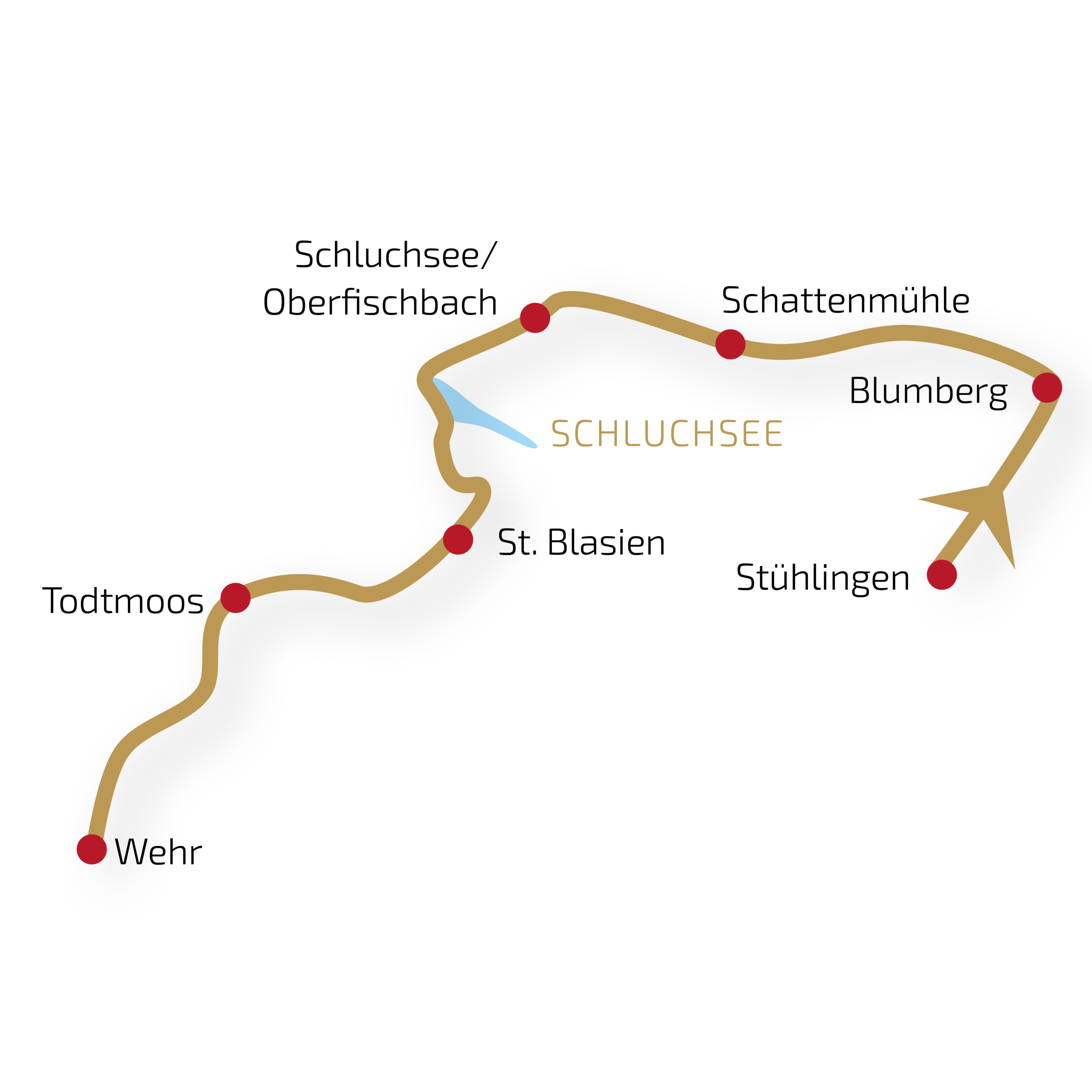
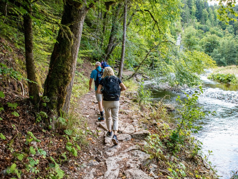
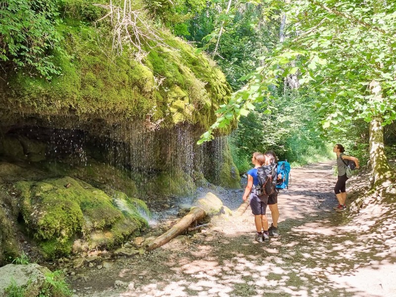
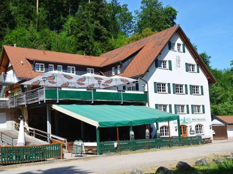
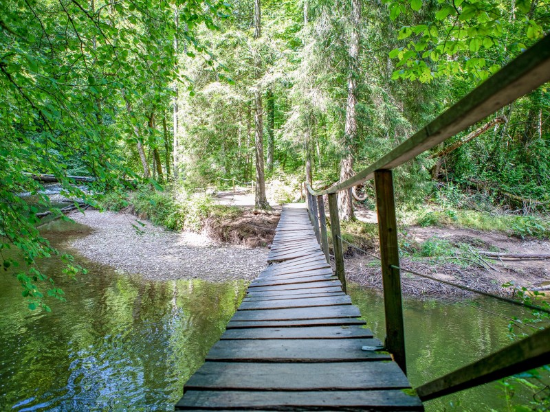
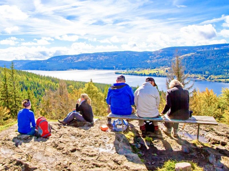
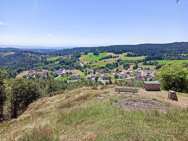
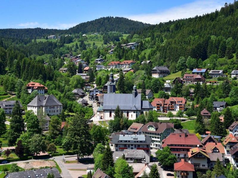
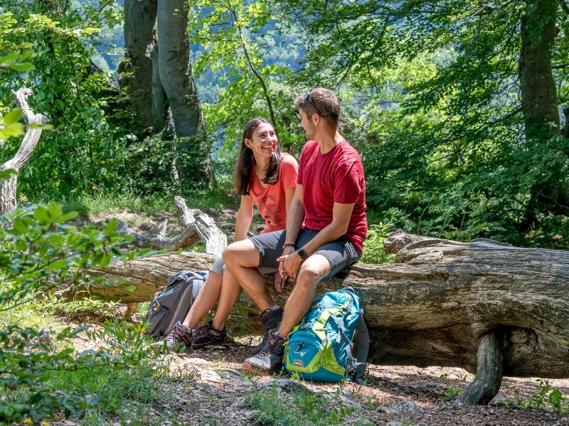
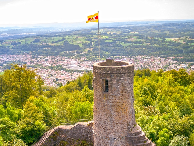
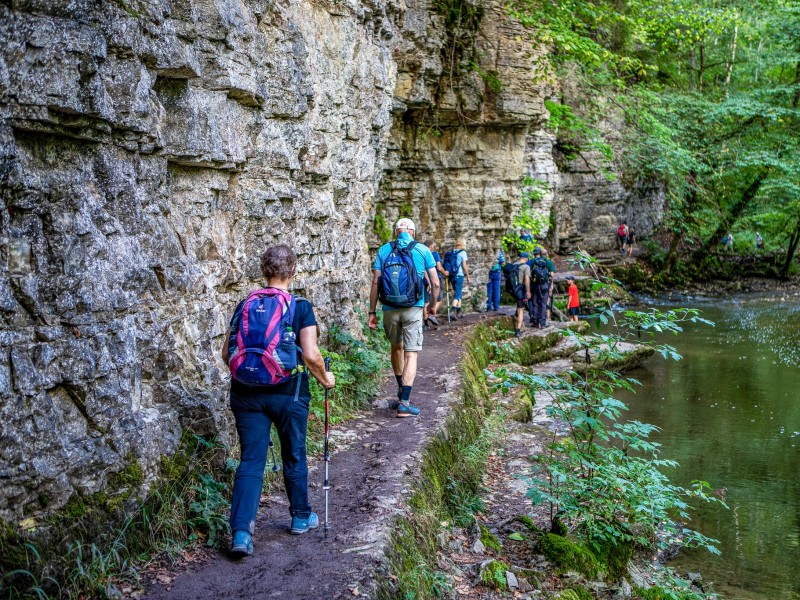
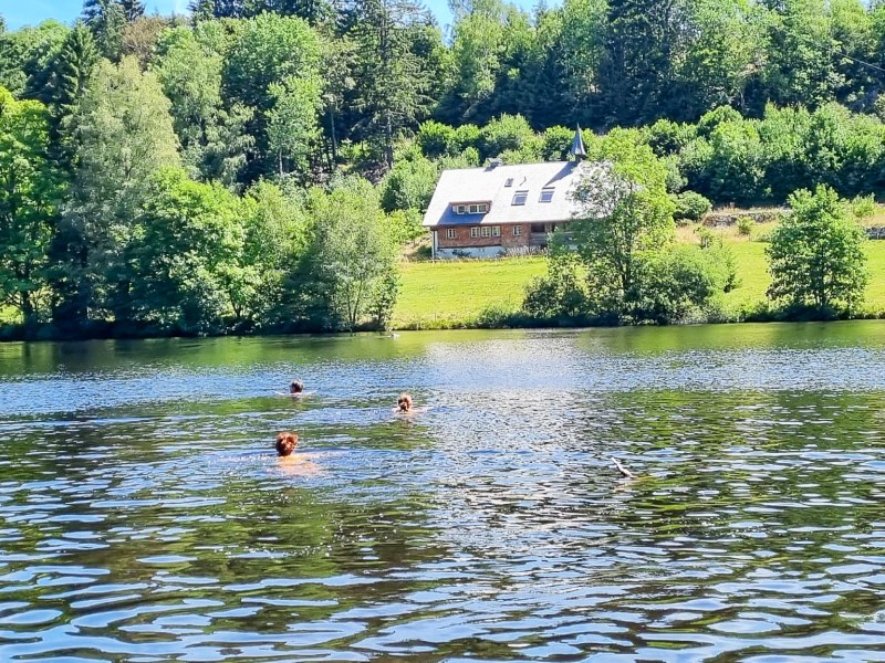
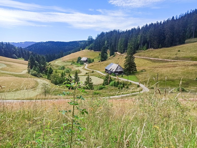
On this hiking trip, you’ll cover the classic 119 km of the Schluchtensteig trail over six stages. The journey begins in Stühlingen, on the Swiss border, and ends in Wehr, not far from the High Rhine River. On the stages—around 20 km each—you’ll hike from hotel to hotel through the Southern Black Forest Nature Park. Water is a constant companion along the way: a total of seven gorges, stunning waterfalls, and countless beautiful viewpoints await you.

Pro Person ab
EUR 799

Highlights der Reise

  • fascinating canyons and ravines
  • Lake Schluchsee and the Cathedral of St. Blasien
  • the diverse landscapes of the Black Forest Nature Park

Reiseverlauf

Tag 1: Arrival - Stühlingen

You will arrive in Stühlingen by train, bus, or your own vehicle during the day.

In Stühlingen, there are public parking lots for hikers close to the city hall. You can park your vehicle for the duration of your hiking trip for free.The nearest train station is Lauchringen. From there, you continue to Stühlingen by public bus.

1. – 2. Tag: Stühlingen

It is primarily known as the starting point for the hike along the Schluchtensteig trail. Additionally, the Southern Black Forest Cycle Path also passes through Stühlingen.

Tag 2: Stühlingen - Blumberg

From Stühlingen to Blumberg. Distance: approx. 19 km | 510 m ascent | 270 m descent

You'll be ascending from the river Rhine to the Baar region. The uphill sections should not be underestimated but are rewarded with impressive views. With a bit of luck, you might encounter the historic Sauschwänzle Railway on the first part of the stage. Later, you'll continue on narrow, root-covered paths through the primeval-like "Wutachflühen" towards Blumberg.

2. – 3. Tag: Blumberg

The cityscape of Blumberg is unusual due to its history. It exhibits characteristics of a mining town, reminiscent of places in the Ruhr area. Blumberg is a state-recognized recreational destination and serves as the starting point for numerous hikes. It is located directly on the Schluchtensteig, Querweg, and WasserWeltenSteig hiking trails.

Tag 3: Blumberg - Schattenmühle

From Blumberg to Schattenmühle. Distance: approx. 20 km | 340 m ascent | 370 m descent

Today, you'll immerse yourself deep into the world of the Black Forest canyons. Between steep, rugged rock walls, the wild Wutach River carves its way through one of the oldest nature reserves in Baden-Württemberg. The trail takes you along the rushing river, waterfalls cascade, and lush greenery surrounds you everywhere. At the end of the stage, a short bus ride will take you from Schattenmühle to Löffingen or Bonndorf. To get to your accommodation in Bonndorf, hike through the beautiful Lotenbachklamm gorge to the bus stop (approx. 1.5 km; 30 min); from there, the hiking bus will take you on a short ride to Bonndorf.

3. – 4. Tag: Löffingen

The name is derived from its deep, "shady" location within the gorge. The first documented evidence of the mill dates back to the year 1596 when a "miller from Göschweiler" is mentioned. Many long-distance hiking trails pass through this area, including the Schluchtensteig, WasserWeltensteig, and Querweg.

Direkt an der Wutachschlucht gelegen

Tag 4: Schattenmühle - Fischbach

From Schattenmühle to Fischbach. Distance: approx. 18 km | 600 m ascent | 240 m descent

From Schattenmühle, you'll pass by Räuberschlössle and Stallegger Holzbrücke (wooden bridge), constantly ascending and descending, exiting the canyon towards Lenzkirch. Especially idyllic spots can be found at the confluences of Rötenbach and Haslach. Taking a little break in Lenzkirch is worth the time because from there, you'll have another steep ascent to Fischbach.

4. – 5. Tag: Schluchsee

Fischbach is situated between Lenzkirch and Schluchsee. Numerous hiking trails run through the valley, with the most famous one being the Schluchtensteig.

Blick über den Ort

Tag 5: Fischbach - St. Blasien

From Fischbach to St. Blasien. Distance: approx. 21 km | 410 m ascent | 670 m descent

Just as you start your hike in the morning, one of the most beautiful views of the tour awaits you: the view from Bildstein down to Schluchsee. On a clear day, you might even see the Alpine peaks. During a break at Unterkrummenhof, you can observe the sparkling waters of the enormous Lake Schluchsee. The route continues along varied forest paths to St. Blasien. Be sure to take a look inside the cathedral with its imposing dome.

5. – 6. Tag: Sankt Blasien

Sankt Blasien is famous for its cathedral. Additionally, it is located right along the Schluchtensteig and Albsteig hiking trails.

Tag 6: St. Blasien - Todtmoos

From St. Blasien to Todtmoos. Distance: approx. 19 km | 540 m ascent | 500 m descent

Today, instead of looking into deep canyons, you'll have numerous viewpoints to gaze into the distance. From the observation tower on Lehenkopf, your view stretches far across the Black Forest. On clear days you can even see the Swiss Jura from Horbacher Heide. A panoramic sign will explain the visible peaks of the Alpine range. Towards the end of the stage, the trail lives up to its name again: you descend into the Hohwehraschlucht and arrive in the town of Todtmoos.

6. – 7. Tag: Todtmoos

Todtmoos is known for its large pilgrimage church and the regular pilgrimages that take place from all directions.

Tag 7: Todtmoos - Wehr

From Todtmoos to Wehr. Distance: approx. 23 km | 410 m ascent | 870 m descent

This stage leads you to Wehr along beautiful forest trails. Along the way, you'll hike on narrow paths with steep slopes. A short additional climb to the Mettlerhütte is worthwhile. The small hut is not staffed, but there is a fountain in front of it where you can refill your water supplies and enjoy the beautiful view. After the Wehratalsperre (Wehra Reservoir), you can almost continue strolling until you arrive in Wehr.

7. – 8. Tag: Wehr

Wehr is a small town situated along the Wehra River, between the Dinkelberg to the west and the High Black Forest to the east. It is characterized by its industrial activities.

Impressionen

Weitere Informationen zur Reise: Schluchtensteig trail – Seven canyons in one week

Enthaltene Leistungen

  • overnight stays in hiking-friendly mid-range accommodations according to the program

  • meals: breakfast
  • luggage transfer from accommodation to accommodation (1 piece of luggage per person, max. 20 kgs)
  • GPX file for route navigation
  • public transportation rides between Löffingen/Bonndorf and the hikers parking lot Schattenmühle (free of charge using KONUS guest card)
  • KONUS guest card in participating towns (free use of public transportation)
  • timetable for hiking buses along the Schluchtensteig trail
  • visitor's taxes where applicable
  • emergency number outside of business hours

Nicht enthaltene Leistungen

  • other meals and beverages

  • optional activities and entrance fees
  • personal expenses, tips, etc.

Hinweise zu den Reiseleistungen

Information on travel services

+++ The listed accommodations are subject to availability. If an accommodation is fully booked during your travel period, we will book an alternative, if possible, in the same standard. This may result in price changes. +++

Please provide any non-binding booking requests, such as allergy bedding, separate beds, vegetarian meals, etc., at the time of booking.

For subsequent booking of additional services or the subsequent notification of booking requests:
a one-time service fee of € 25.00 will apply.


Information about the trip

Best Travel Time
This trip can be booked from April to October.

Dogs
You’re welcome to bring your four-legged friend. To do so, please book the corresponding trip under our Dog-Friendly Tours.

Special Features of the Trail
The Schluchtensteig is characterized by narrow paths and wild trails through the gorges, as well as quiet forest paths along the Black Forest heights. Especially in the Wutach Gorge, paths run through deep gorges and along steep slopes—surefootedness and a head for heights are required. This trip is not suitable for people with reduced mobility.

Parking
In Stühlingen, public parking is available where you can leave your vehicle free of charge for the duration of your hiking trip.

Return to the Starting Point
From all stage locations, you can use the KONUS guest card to return to your starting point via public transport free of charge. The journey takes between 1.5 and 3 hours depending on the route and usually involves several changes. Please note: Stühlingen is not part of the KONUS system. If you wish to leave your car at the destination on arrival day and travel to Stühlingen first, you will need to purchase a ticket. Alternatively, a private taxi transfer can be booked through us (€226 for 1–3 persons; €235 for 4–8 persons).

KONUS
With the KONUS guest card, you can use public transport in the Black Forest free of charge. Please check the details here.

Individual Adjustments
Do you have any special requests? For example, taking a rest day or carrying your luggage yourself? Contact us—we’ll be happy to prepare a customized offer wherever possible!

Group Discount
Traveling with friends? The more, the merrier—and cheaper: for groups of 5 or more, the total price is reduced by 4%; for 10 or more, by 10%. Get in touch, and we’ll create a tailored offer for you.

Other Hiking Trips
All self-guided hiking tours with luggage transfer can be found here: Hiking without luggage!

+ Zimmer hinzufuegen

Bewertungen

Der Gepäcktransfer hat hervorragend geklappt. Die Unterbringung war unterschiedlich gut und wir fanden den Preis dafür sehr hoch : von Absteige über einfacher Landgasthof bis Hotel. Schade fanden wir es, dass wir nicht in der Schattenmühle untergebracht wurden und so noch bis zur Strasse zum Bus hoch- und am nächsten Tag wieder runter kraxeln mussten. Das Gasthaus Kranz in Bonndorf war aber dann sehr nett. Wir fanden die erste Etappe von Stühlingen nicht so besonders schön und hätten rückblickend eher auf diese als suf die letzte Etappe von Todtmoos nach Wehr verzichtet (wir hatten ja leider nur 6 Tage Zeit ) Schade war es (daran trägt der Veranstalter natürlich keine Schuld), dass es unterwegs nur selten Einkehrmöglichkeiten gab.
07.10.2025

|

Anonym
Die Organisation war perfekt, das Gepäck immer schon vor Ort bei Ankunft, die Website war sehr übersichtlich, gut, dass man Optionen anklicken konnte. Bei der Hotelauswahl musste man weit scrollen, um die Alternativen zu sehen, das war am Anfang irritierend. Der mitgeschickte Wanderführer war sehr hilfreich, das Essen am Abend war besonders gut im Rössli, Stühlingen, Schattenmühle und Hirschen, Fischbach. Die Etappen hatten die perfekte Länge. Wir würden jederzeit wieder mit Original-Landreisen wandern gehen.
06.10.2025

|

Anonym
Hervorragende Organisation vor und während der Wanderung, sehr sehr gute Quartiere für Übernachtungen und Abendessen, und eine wunderbare Wanderstrecke. Besser geht's nicht.
06.10.2025

|

Max
Die Informationen zur Schattenmühle waren falsch (kein Fernsehen - es war Fernsehen da. Betten selbst machen müssen - waren gemacht). Keine Infos zu Einkaufsmöglichkeiten fürs Vesper, keine Erfahrungen beim ÖPNV bei einer Rückfrage - der Eindruck, dass wir nach Hotelreservierungen und Organisation des Gepäcktransports vom Anbieter nicht mehr erfahren als auch Google weiss. Das ist wenig fürs Geld und haben wir schon anders erlebt.
04.10.2025

|

Anonym
Ich habe folgende Kritikpunkte: Wir hatten in der Schattenmühle gebucht und waren im Vorfeld informiert worden, dass man a) die Betten selber beziehen muss und b) keine Fernseher vorhanden ist. Das hätte uns nicht gestört - tatsächlich war aber beides nicht der Fall. Offenbar hat sich dort in letzter Zeit einiges geändert (verbessert). Ein Reiseveranstalter sollte hier die aktuellen Infos haben. Auf Etappe 4 des Schluchtensteigs wurde ich ca. 2 Stunden vor Todtmoos in Schweizer Mobilfunknetzt eingeloggt. Das war unerwartet, scheint aber um Todtmoos herum normal zu sein. Das kann schnell zur Kostenfalle werden, ein Hinweis darauf wäre nett gewesen. In keinem der Übernachtungs-Orte war es möglich, fußläufig einen Laden zu finden um Proviant zu kaufen. Unerwartet mitten in Deutschland, auch hier wäre in Hinweis gut gewesen. Für die Rückreise von Todtmoos nach Stühlingen wurde uns eine Busverbindung mit 2 min Umstiegszeit empfohlen ... das hätte nie gereicht, der erste Bus hatte 5 min Verspätung. Gut dass wir es selber noch gemerkt haben und eine andere Verbindung ausgesucht haben. Wir hatten extra einen lokalen Reiseveranstalter "vor Ort" ausgewählt, weil wir gehofft hatten, dass dieser sich tatsächlich vor Ort auch auskennt - das ist offenbar nicht der Fall oder man macht sich nicht die Mühle zu recherchieren. Schade.
28.09.2025

|

Anonym
Sehr freundliche Betreuung, danke an das Team
26.09.2025

|

Karin
I really enjoyed the hike. It was physically challenging but safe and within my ability - I got fitter as the trip went on. The walking footpaths were excellent and entertaining whereas the forest trails especially between Aha and St Blasien were tedious - but you can't have everything! The baggage transfer worked well and the guest houses/ hotels were generally of a high standard. There were rest days at a few of the stops - Blumberg was a bit dreary and a search to find food. But there were usually suitable options.
11.09.2025

|

Joe Dooley
Liebes Team, grundsätzlich waren unsere Erfahrungen positiv. Gern möchten wir noch 3 Hinweise geben: 1. Schön wäre es, wenn man vielleicht noch die Wasserstellen /Quellen mit angibt. Dann könnte man sich super mit Wasser versorgen. 2. Am Tag 3 mussten wir zusätzlich durch die Lotenbachklamm. Jedoch wurde das an Tag 4 nicht noch einmal erwähnt. Andere Reisende hatten uns ebenfalls gefragt, ob man noch einmal durch die Lotenbachklamm müsse. Wor haben es gemacht. Ein Hinweis zu Tag 4 das dies leider nochmal erforderlich ist, wäre schön gewesen. 3. Am letzte Tag läuft man die meiste Zeit am Hang entlang, ohne eine schöne Pausenstelle. Durch einen Einheimischen wurde uns der Tipp zu einer Hütte gegeben, welche keine 2 Minuten vom Weg weg liegt. Dort hat man Bänke, eine wunderbare Aussicht und auch Wasser. Das wäre vielleicht für die nächsten Wanderer ein toller Tipp. Anbei die Koordinaten: https://maps.app.goo.gl/vuekFEh8XHMPNVgt9 Gern kann ich auch meine gpx Daten zur Verfügung stellen. Dann sieht man es auch nochmal. Der Gepäcktransport lief super und wir hatten eine wundervolle Zeit. Vielen Dank! Liebe Grüße Franzi
10.09.2025

|

Franzi
Die Unterkunft am letzten Tag in Wehr( "Zur Sonne")war ein echtes Highlight, besonders nach der langen Tour und den etwas "öden" letzten km quer durch die Stadt.- Der Verzicht auf die "Schattenmühle" direkt am Weg war nach den Erfahrungen anderer Wanderer wohl kein Nachteil.
09.09.2025

|

Anonym
Vous êtes bien organisé et merci à Annemarie.
09.09.2025

|

Anonym