
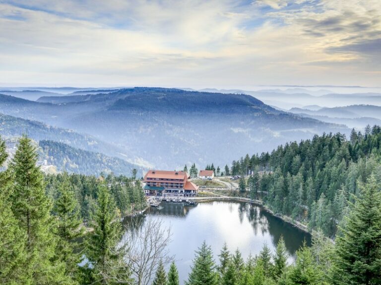
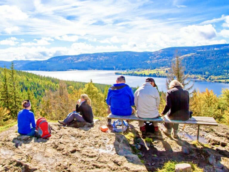
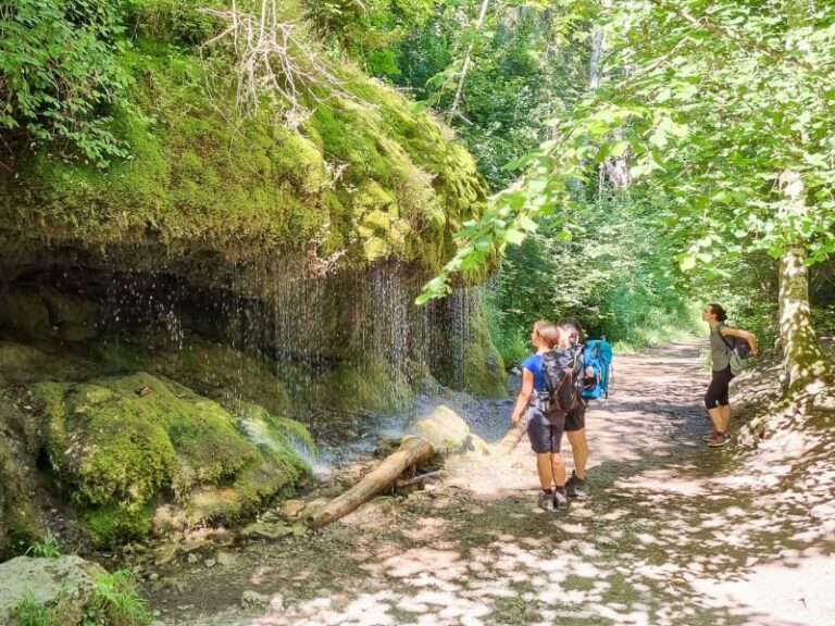
Explore different landscapes
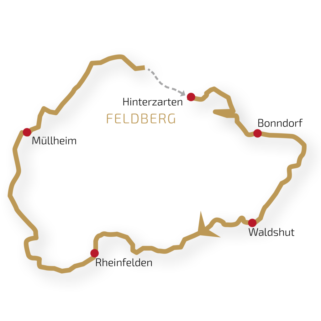
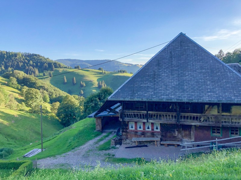
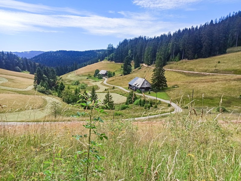
The most famous long-distance cycling tour of the Black Forest. The scenic tour offers natural beauty, charming villages, cultural heritage, romantic wine regions and historic cities.
Distance: approx. 45 km | 380 m ascent | 410 m descent
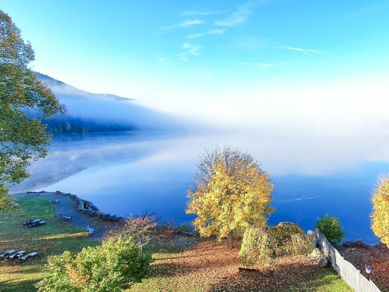
Full of anticipation, you hop on your bike this morning and pedal effortlessly out of beautiful Hinterzarten. A few rotations of the pedals later, you head straight towards the shores of Lake Titisee. Riding right past the promenade, you follow the course of the Gutach River with gentle ups and downs. Soon, your eyes catch the sight of the famous Hochfirst ski jump, standing out on the mountainside amid tall fir trees. Following the scenic Bähnle cycle path (Bähnle-Radweg) along the railway tracks, you pass through Lenzkirch and eventually reach your destination in Bonndorf through the tree-lined Philosophenweg (Philosopher’s Path)
Distance: approx. 55 km | 160 m ascent | 710 m descent
Today, you can give your muscles a break because just a few kilometers beyond Bonndorf, the cycle path descends, allowing you to simply go with the flow. The cycling route takes you along the wild and romantic Wutach Gorge. However, you can only explore this gorge on foot. Taking a short detour on your bike and climbing a few meters to the beautiful viewpoint called Wutachflühen is definitely worth it. From there, you’ll have a view down into the deeply carved riverbeds with their unique wildlife and plant species. Along the Sauschwänzle Railway and the Wutach River, the stage finally ends among the townhouses in the city center of Waldshut.
Distance: approx. 45 km | 140 m ascent | 160 m descent
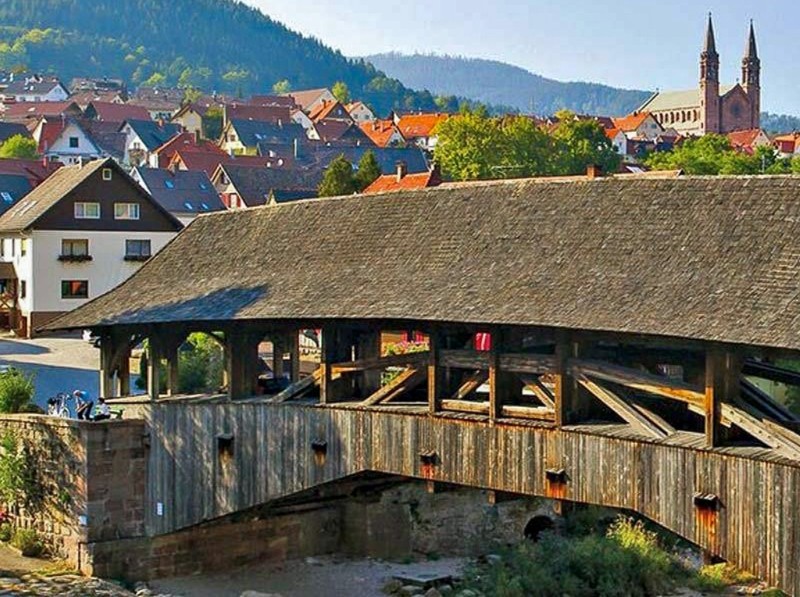
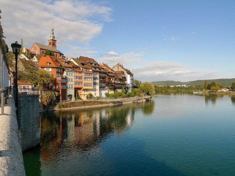
The High Rhine will be your constant companion for the next few hours. Just a stone’s throw from Switzerland, you can decide whether you want to cross the wide river at Dogern and cycle along the Swiss side. Along the way, you’ll encounter the town of Laufenburg, which is quite unique – it’s divided between two countries and separated by the natural border of the Rhine. Cycling beneath the shade of thick, overhanging branches, you’ll reach Bad Säckingen with its distinctive onion-domed basilica and Europe’s longest covered wooden bridge. Finally, you’ll arrive in Rheinfelden after passing through the nature reserve along the river mouth of the Wehra river.
Distance: approx. 65 km | 230 m ascent | 290 m descent
On the Swiss side of the Rhine, after a few kilometers, you will pass by the impressive Roman city of Augusta Raurica, known for its numerous excavations and the impressive amphitheater. Next highlight of your journey is a little walk threw the historic city of Basel. The longest arch bridge for cyclists and pedestrians will lead you back to the German side of the Rhine.
Alternatively, today you can choose the route over the Dinkelberg from Rheinfelden, which is equally charming with Villa Rustica and the ruins of Rötteln Castle, not to mention the beer garden. This route involves a bit more elevation gain.
Distance: approx. 50 km | 330 m ascent | 160 m descent
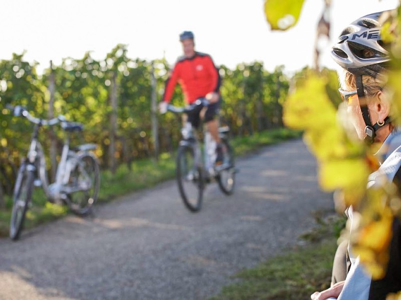
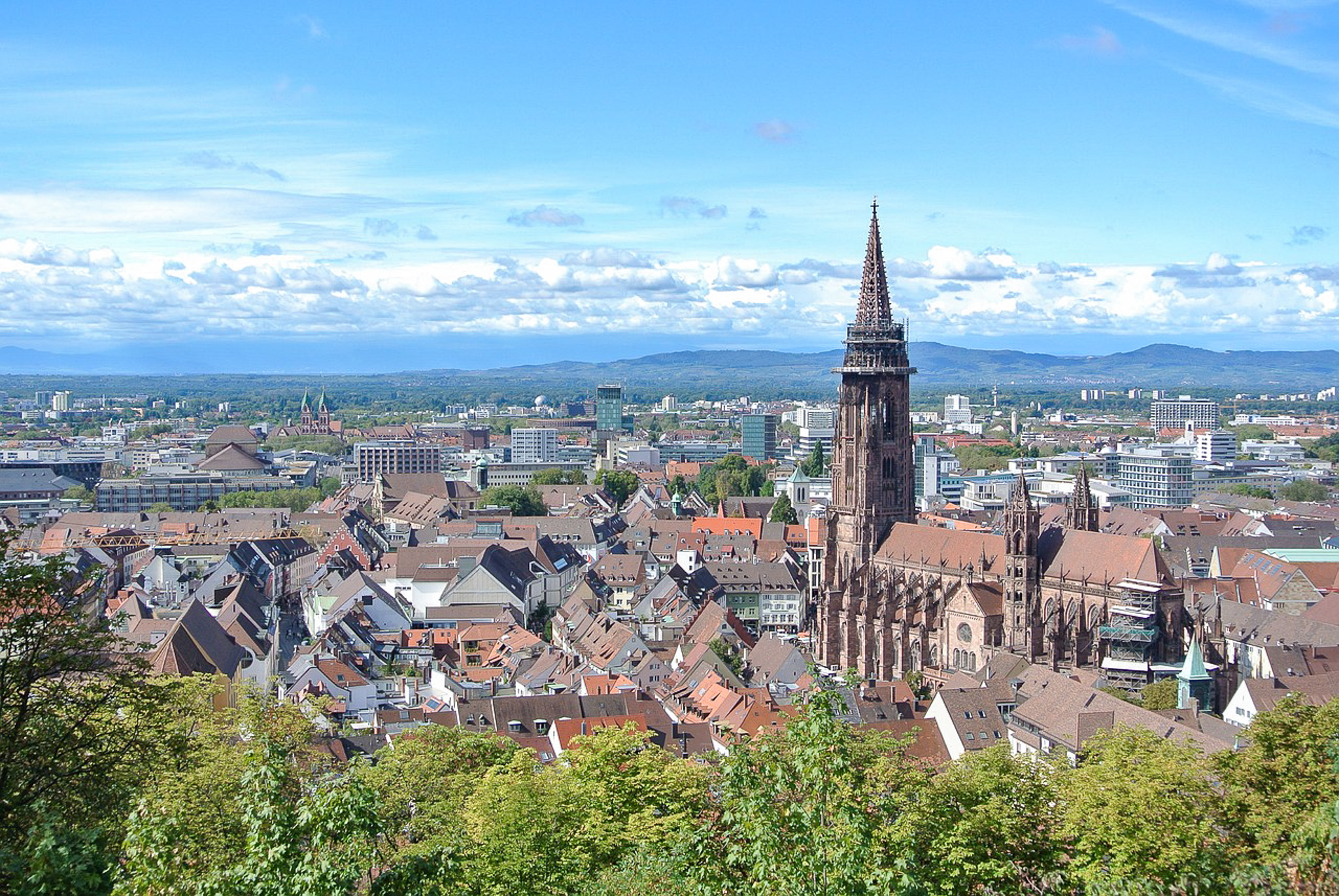
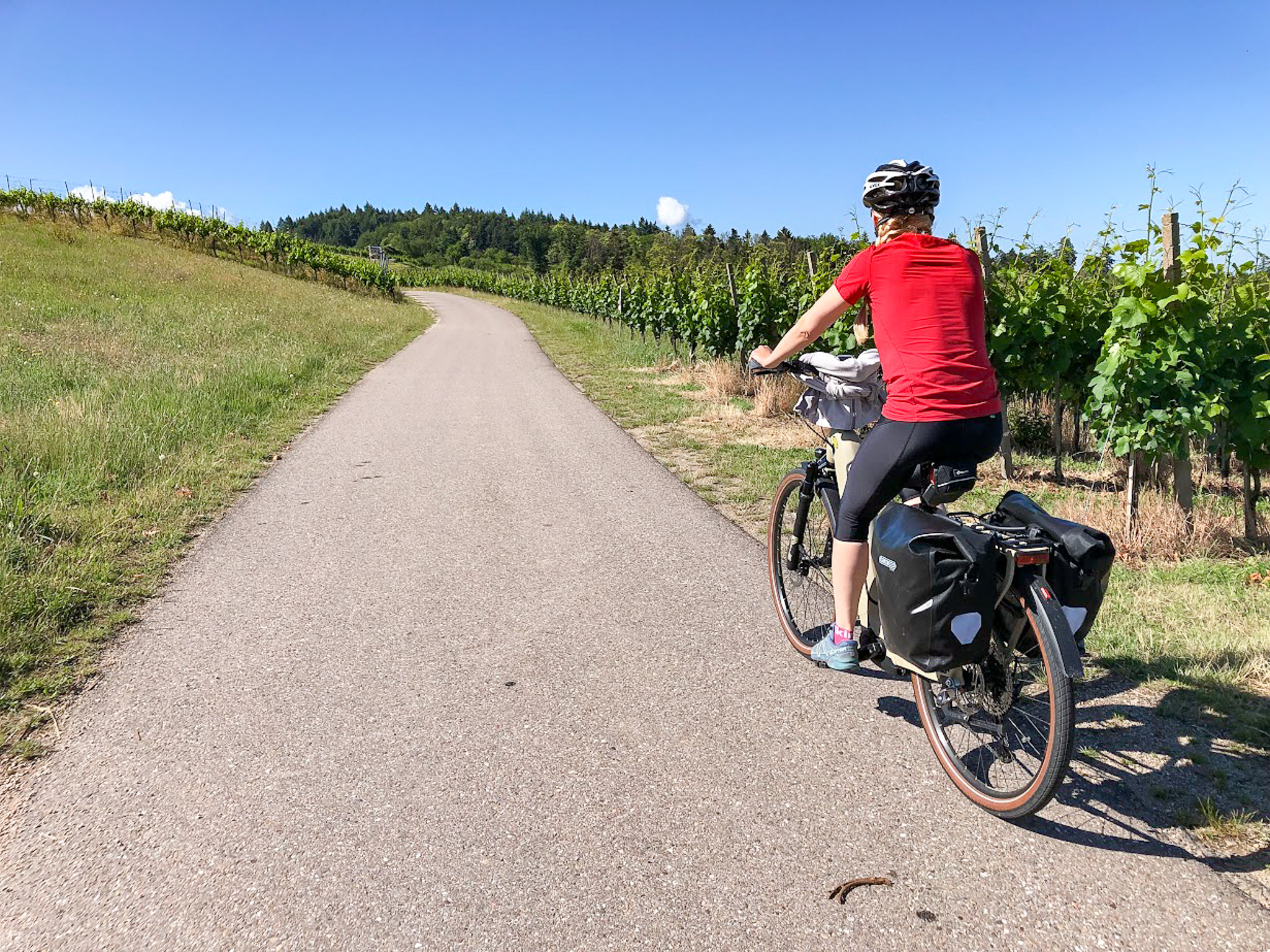
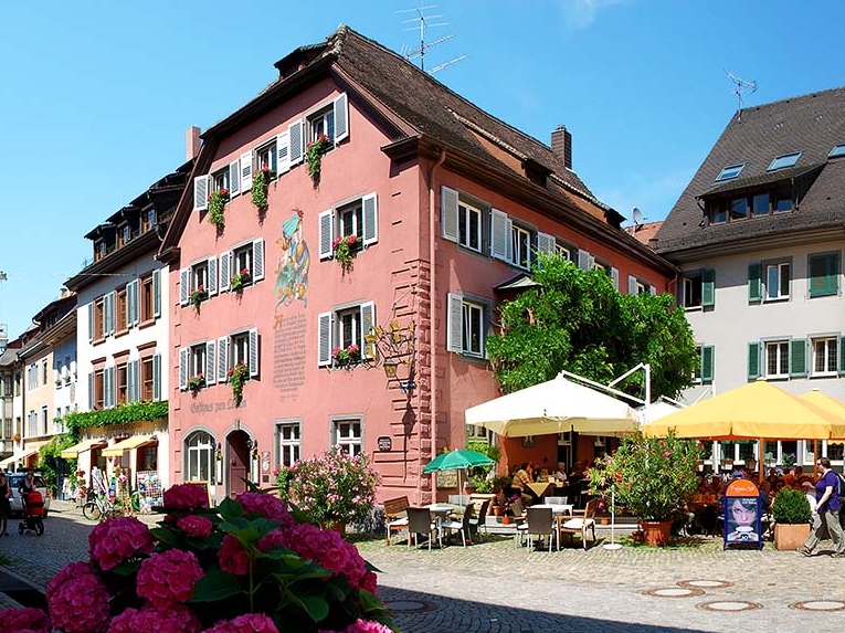
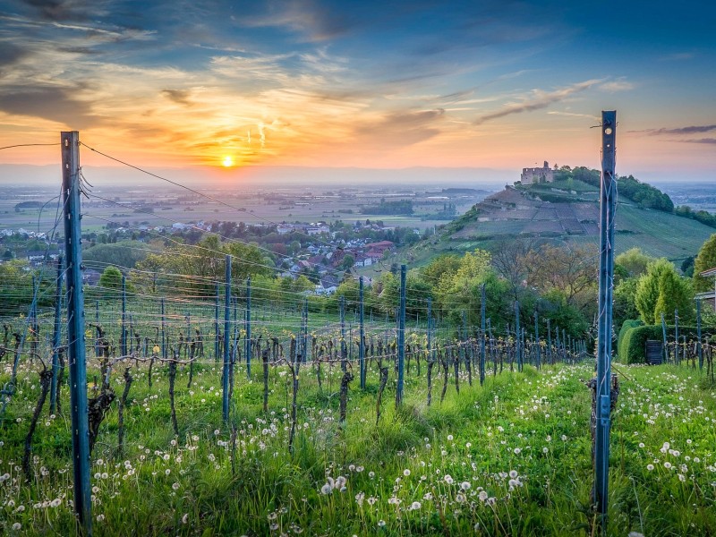
The route takes you through the hilly vineyards of the charming Markgräflerland region, passing through the town of Staufen before reaching Freiburg. The city of Freiburg is known as a cycling hub, and it’s enjoyable to explore its winding streets in the lovely old town by bike. Finally, in Kirchzarten in the Dreisam Valley, the South Black Forest Cycle Path ends. You can cover the last steep kilometers comfortably by taking the Höllentalbahn (Höllental Railway) from Kirchzarten to Hinterzarten.
individual hiking tour
- Enjoy the quiet idyll of the Black Forest
- Hike off the main route on peaceful trails
- Marvel at stunning panoramic views from the two highest peaks of the Black Forest
Difficulty:
individual hiking tour
Difficulty:
- Enjoy the quiet idyll of the Black Forest
- Hike off the main route on peaceful trails
- Marvel at stunning panoramic views from the two highest peaks of the Black Forest
individual hiking tour
- the highest and most beautiful peak in the Black Forest
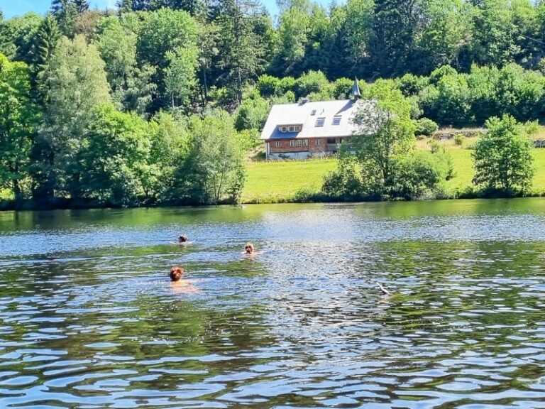
- a Black Forest classic: Lake Feldsee
- charming landscapes of the Markgräflerland region
Difficulty:
individual hiking tour
Difficulty:
- the highest and most beautiful peak in the Black Forest
- a Black Forest classic: Lake Feldsee
- charming landscapes of the Markgräflerland region
individual hiking tour
- the highest and the most beautiful peak in the Black Forest
- a Black Forest classic: Lake Titisee
- charming landscapes of the Markgräflerland region
Difficulty:
individual hiking tour
Difficulty:
- the highest and the most beautiful peak in the Black Forest
- a Black Forest classic: Lake Titisee
- charming landscapes of the Markgräflerland region
individual hiking tour
- beautiful, unspoiled moorland plateaus
- a Black Forest classic: Lake Mummelsee
- the fairytale high moor of Kaltenbronn
Difficulty:
individual hiking tour
Difficulty:
- beautiful, unspoiled moorland plateaus
- a Black Forest classic: Lake Mummelsee
- the fairytale high moor of Kaltenbronn
individual hiking tour
- cross the entire Black Forest from north to south
- experience breathtaking panoramic views over the Black Forest and the Rhine Valley
- discover the highest Black Forest peaks
Difficulty:
individual hiking tour
Difficulty:
- cross the entire Black Forest from north to south
- experience breathtaking panoramic views over the Black Forest and the Rhine Valley
- discover the highest Black Forest peaks
individual hiking tour
- enjoy the peaceful idyll of the Black Forest
- hike off the main route on quiet trails
- take in breathtaking panoramic views from the two highest peaks of the Black Forest
Difficulty:
individual hiking tour
Difficulty:
- enjoy the peaceful idyll of the Black Forest
- hike off the main route on quiet trails
- take in breathtaking panoramic views from the two highest peaks of the Black Forest
individual hiking tour
- the highest and most beautiful peak in the Black Forest
- a Black Forest classic: Lake Feldsee
- charming landscapes of the Markgräflerland region
Difficulty:
individual hiking tour
Difficulty:
- the highest and most beautiful peak in the Black Forest
- a Black Forest classic: Lake Feldsee
- charming landscapes of the Markgräflerland region
individual hiking tour
- the highest and the most beautiful peak in the Black Forest
- a Black Forest classic: Lake Titisee
- charming landscapes of the Markgräflerland region
Difficulty:
individual hiking tour
Difficulty:
- the highest and the most beautiful peak in the Black Forest
- a Black Forest classic: Lake Titisee
- charming landscapes of the Markgräflerland region
individual hiking tour
- beautiful, unspoiled moorland plateaus
- a Black Forest classic: Lake Mummelsee
- the fairytale high moor of Kaltenbronn
Difficulty:
individual hiking tour
Difficulty:
- beautiful, unspoiled moorland plateaus
- a Black Forest classic: Lake Mummelsee
- the fairytale high moor of Kaltenbronn
individual hiking tour
- cross the entire Black Forest from north to south
- experience breathtaking panoramic views over the Black Forest and the Rhine Valley
- discover the highest Black Forest peaks
Difficulty:
individual hiking tour
Difficulty:
- cross the entire Black Forest from north to south
- experience breathtaking panoramic views over the Black Forest and the Rhine Valley
- discover the highest Black Forest peaks
Individuelle Wanderreise
- stille Schwarzwald-Idylle genießen
- wandern abseits der Hauptroute auf ruhigen Strecken
- herrliche Panoramasichten von den zwei höchsten Schwarzwald-Gipfeln
Difficulty:
Individuelle Wanderreise
Difficulty:
- stille Schwarzwald-Idylle genießen
- wandern abseits der Hauptroute auf ruhigen Strecken
- herrliche Panoramasichten von den zwei höchsten Schwarzwald-Gipfeln
Individuelle Wanderreise
- der höchste und der schönste Gipfel im Schwarzwald
- typisch Schwarzwald: der Feldsee
- liebliche Landschaft im Markgräflerland
Difficulty:
Individuelle Wanderreise
Difficulty:
- der höchste und der schönste Gipfel im Schwarzwald
- typisch Schwarzwald: der Feldsee
- liebliche Landschaft im Markgräflerland
Individuelle Wanderreise
- der höchste und der schönste Gipfel im Schwarzwald
- typisch Schwarzwald: Titisee
- liebliche Landschaft im Markgräflerland
Difficulty:
Individuelle Wanderreise
Difficulty:
- der höchste und der schönste Gipfel im Schwarzwald
- typisch Schwarzwald: Titisee
- liebliche Landschaft im Markgräflerland
Individuelle Wanderreise
- wunderschöne ursprüngliche Grindenlandschaften
- typisch Schwarzwald: der Mummelsee
- märchenhaftes Hochmoor Kaltenbronn
Difficulty:
Individuelle Wanderreise
Difficulty:
- wunderschöne ursprüngliche Grindenlandschaften
- typisch Schwarzwald: der Mummelsee
- märchenhaftes Hochmoor Kaltenbronn
Individuelle Wanderreise
- den Schwarzwald komplett von Nord nach Süd durchqueren
- faszinierende Weitsichten über Schwarzwald und Rheintal
- Schwarzwald-Gipfel-Tour
Difficulty:
Individuelle Wanderreise
Difficulty:
- den Schwarzwald komplett von Nord nach Süd durchqueren
- faszinierende Weitsichten über Schwarzwald und Rheintal
- Schwarzwald-Gipfel-Tour
Individuelle Tourenradreise
- fast ohne Höhenmeter durch den Südschwarzwald radeln
- dem Fluss der Wutach und des Hochrheins folgen
- durch die wunderschönen Altstädte von Waldshut, Bad Säckingen, Basel und Freiburg flanieren
Difficulty:
Individuelle Tourenradreise
Difficulty:
- fast ohne Höhenmeter durch den Südschwarzwald radeln
- dem Fluss der Wutach und des Hochrheins folgen
- durch die wunderschönen Altstädte von Waldshut, Bad Säckingen, Basel und Freiburg flanieren
individual hiking tour
- deep gorges & blooming meadows
- “Pearls of the Black Forest”: Lake Schluchsee, St. Blasien Cathedral
- the scenic diversity of the Southern Black Forest Nature Park
Difficulty:
individual hiking tour
Difficulty:
- deep gorges & blooming meadows
- “Pearls of the Black Forest”: Lake Schluchsee, St. Blasien Cathedral
- the scenic diversity of the Southern Black Forest Nature Park
individual hiking tour
- start of the tour at Lake Schluchsee, the largest lake in the Black Forest
- cultural landmark: St. Blasien Cathedral
- through primeval forest and the Wehraschlucht gorge
Difficulty:
individual hiking tour
Difficulty:
- start of the tour at Lake Schluchsee, the largest lake in the Black Forest
- cultural landmark: St. Blasien Cathedral
- through primeval forest and the Wehraschlucht gorge
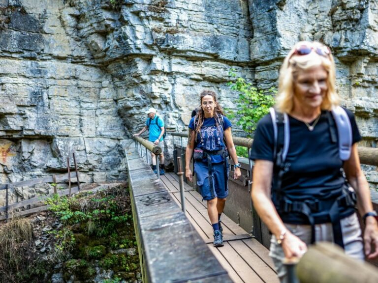
individual hiking tour
- primeval-like landscape in the Wutach cliffs
- steep rocks, babbling streams, blooming meadows
- through the impressive Wutach Gorge
Difficulty:
individual hiking tour
Difficulty:
- primeval-like landscape in the Wutach cliffs
- steep rocks, babbling streams, blooming meadows
- through the impressive Wutach Gorge
individual hiking tour
- deep gorges & blooming meadows
- “Pearls of the Black Forest”: Lake Schluchsee, St. Blasien Cathedral
- the scenic diversity of the Southern Black Forest Nature Park
Difficulty:
individual hiking tour
Difficulty:
- deep gorges & blooming meadows
- “Pearls of the Black Forest”: Lake Schluchsee, St. Blasien Cathedral
- the scenic diversity of the Southern Black Forest Nature Park
individual hiking tour
- deep gorges & blooming meadows
- “Pearls of the Black Forest”: Lake Schluchsee, St. Blasien Cathedral
- the scenic diversity of the Southern Black Forest Nature Park
Difficulty:
individual hiking tour
Difficulty:
- deep gorges & blooming meadows
- “Pearls of the Black Forest”: Lake Schluchsee, St. Blasien Cathedral
- the scenic diversity of the Southern Black Forest Nature Park
individual hiking tour
- start of the tour at Lake Schluchsee, the largest lake in the Black Forest
- cultural landmark: St. Blasien Cathedral
- through primeval forest and the Wehraschlucht gorge
Difficulty:
individual hiking tour
Difficulty:
- start of the tour at Lake Schluchsee, the largest lake in the Black Forest
- cultural landmark: St. Blasien Cathedral
- through primeval forest and the Wehraschlucht gorge
individual hiking tour
- primeval-like landscape in the Wutach cliffs
- steep rocks, babbling streams, blooming meadows
- through the impressive Wutach Gorge
Difficulty:
individual hiking tour
Difficulty:
- primeval-like landscape in the Wutach cliffs
- steep rocks, babbling streams, blooming meadows
- through the impressive Wutach Gorge
individual hiking tour
- fascinating canyons and ravines
- Lake Schluchsee and the Cathedral of St. Blasien
- the diverse landscapes of the Black Forest Nature Park
Difficulty:
individual hiking tour
Difficulty:
- fascinating canyons and ravines
- Lake Schluchsee and the Cathedral of St. Blasien
- the diverse landscapes of the Black Forest Nature Park
Individuelle Wanderreise
- tiefe Schluchten & blühende Weiden
- „Perlen des Schwarzwalds“: Schluchsee, Dom von St. Blasien
- landschaftliche Vielfalt des Naturpark Südschwarzwald
Difficulty:
Individuelle Wanderreise
Difficulty:
- tiefe Schluchten & blühende Weiden
- „Perlen des Schwarzwalds“: Schluchsee, Dom von St. Blasien
- landschaftliche Vielfalt des Naturpark Südschwarzwald
Individuelle Wanderreise
- Beginn der Tour am größten Schwarzwald-See, dem Schluchsee
- Kultur-Denkmal: Dom von St. Blasien
- durch Bannwald und die Wehraschlucht
Difficulty:
Individuelle Wanderreise
Difficulty:
- Beginn der Tour am größten Schwarzwald-See, dem Schluchsee
- Kultur-Denkmal: Dom von St. Blasien
- durch Bannwald und die Wehraschlucht
Individuelle Wanderreise
- urwaldartige Landschaft in den Wutachflühen
- steile Felsen, plätscherndes Wasser, blühende Wiesen
- durch die beeindruckende Wutachschlucht
Difficulty:
Individuelle Wanderreise
Difficulty:
- urwaldartige Landschaft in den Wutachflühen
- steile Felsen, plätscherndes Wasser, blühende Wiesen
- durch die beeindruckende Wutachschlucht
Individuelle Wanderreise
- Faszinierende Schluchten und Klammen
- Schluchsee und der Dom von St. Blasien
- landschaftliche Vielfalt des Naturpark Südschwarzwald
Difficulty:
Individuelle Wanderreise
Difficulty:
- Faszinierende Schluchten und Klammen
- Schluchsee und der Dom von St. Blasien
- landschaftliche Vielfalt des Naturpark Südschwarzwald
Individuelle Wanderreise
- stille Schwarzwald-Idylle genießen
- wandern abseits der Hauptroute auf ruhigen Strecken
- herrliche Panoramasichten von den zwei höchsten Schwarzwald-Gipfeln
Difficulty:
Individuelle Wanderreise
Difficulty:
- stille Schwarzwald-Idylle genießen
- wandern abseits der Hauptroute auf ruhigen Strecken
- herrliche Panoramasichten von den zwei höchsten Schwarzwald-Gipfeln
Individuelle Wanderreise
- der höchste und der schönste Gipfel im Schwarzwald
- typisch Schwarzwald: der Feldsee
- liebliche Landschaft im Markgräflerland
Difficulty:
Individuelle Wanderreise
Difficulty:
- der höchste und der schönste Gipfel im Schwarzwald
- typisch Schwarzwald: der Feldsee
- liebliche Landschaft im Markgräflerland
Individuelle Wanderreise
- der höchste und der schönste Gipfel im Schwarzwald
- typisch Schwarzwald: Titisee
- liebliche Landschaft im Markgräflerland
Difficulty:
Individuelle Wanderreise
Difficulty:
- der höchste und der schönste Gipfel im Schwarzwald
- typisch Schwarzwald: Titisee
- liebliche Landschaft im Markgräflerland
Individuelle Wanderreise
- wunderschöne ursprüngliche Grindenlandschaften
- typisch Schwarzwald: der Mummelsee
- märchenhaftes Hochmoor Kaltenbronn
Difficulty:
Individuelle Wanderreise
Difficulty:
- wunderschöne ursprüngliche Grindenlandschaften
- typisch Schwarzwald: der Mummelsee
- märchenhaftes Hochmoor Kaltenbronn
Individuelle Wanderreise
- den Schwarzwald komplett von Nord nach Süd durchqueren
- faszinierende Weitsichten über Schwarzwald und Rheintal
- Schwarzwald-Gipfel-Tour
Difficulty:
Individuelle Wanderreise
Difficulty:
- den Schwarzwald komplett von Nord nach Süd durchqueren
- faszinierende Weitsichten über Schwarzwald und Rheintal
- Schwarzwald-Gipfel-Tour
Individuelle Wanderreise
- tiefe Schluchten & blühende Weiden
- „Perlen des Schwarzwalds“: Schluchsee, Dom von St. Blasien
- landschaftliche Vielfalt des Naturpark Südschwarzwald
Difficulty:
Individuelle Wanderreise
Difficulty:
- tiefe Schluchten & blühende Weiden
- „Perlen des Schwarzwalds“: Schluchsee, Dom von St. Blasien
- landschaftliche Vielfalt des Naturpark Südschwarzwald
Individuelle Wanderreise
- Beginn der Tour am größten Schwarzwald-See, dem Schluchsee
- Kultur-Denkmal: Dom von St. Blasien
- durch Bannwald und die Wehraschlucht
Difficulty:
Individuelle Wanderreise
Difficulty:
- Beginn der Tour am größten Schwarzwald-See, dem Schluchsee
- Kultur-Denkmal: Dom von St. Blasien
- durch Bannwald und die Wehraschlucht
Individuelle Wanderreise
- urwaldartige Landschaft in den Wutachflühen
- steile Felsen, plätscherndes Wasser, blühende Wiesen
- durch die beeindruckende Wutachschlucht
Difficulty:
Individuelle Wanderreise
Difficulty:
- urwaldartige Landschaft in den Wutachflühen
- steile Felsen, plätscherndes Wasser, blühende Wiesen
- durch die beeindruckende Wutachschlucht
Individuelle Wanderreise
- tiefe Schluchten & blühende Weiden
- „Perlen des Schwarzwalds“: Schluchsee, Dom von St. Blasien
- landschaftliche Vielfalt des Naturpark Südschwarzwald
Difficulty:
Individuelle Wanderreise
Difficulty:
- tiefe Schluchten & blühende Weiden
- „Perlen des Schwarzwalds“: Schluchsee, Dom von St. Blasien
- landschaftliche Vielfalt des Naturpark Südschwarzwald
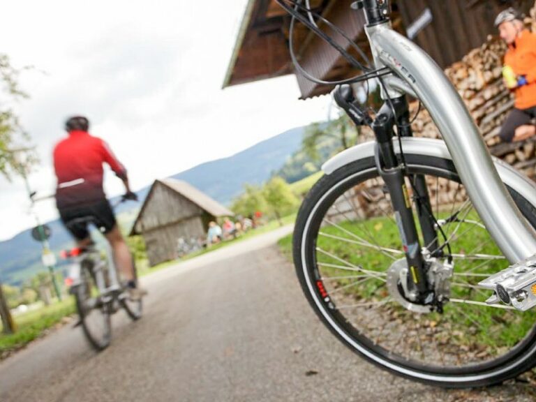
individual bicycle roundtrip
- bike through the Southern Black Forest with hardly any elevation gain
- follow the Wutach River and River Rhine
- stroll through the beautiful old towns of Waldshut, Bad Säckingen, Basel and Freiburg
Difficulty:
individual bicycle roundtrip
Difficulty:
- bike through the Southern Black Forest with hardly any elevation gain
- follow the Wutach River and River Rhine
- stroll through the beautiful old towns of Waldshut, Bad Säckingen, Basel and Freiburg
Who is the Black Forest Cycling Tour suitable for?
This cycling tour on the Black Forest Cycle Route is ideal for couples, small groups and individual travellers.
This trip is not suitable for people with limited mobility.
Requirements & difficulty
Which level does the trail have?
According to our definitions, it’s a level 2 trail:
2 Points = easy | distance: 30-50 kilometers | elevation gain: none (minimal inclines are unavoidable) | profile: mostly flat routes, but longer distances than Level 1
You occasionally ride your bike for leisure. You enjoy cycling on flat routes that offer a smooth ride. While you don’t mind minimal inclines, you prefer to keep them short.
Characteristics of the trail
The Black Forest Cycle Route mostly runs on cycle paths and quiet secondary roads. The route is generally downhill or flat with few short ascents. There are only minor elevation differences to overcome, with the largest one from Kirchzarten to Hinterzarten, being covered by train. The paths are well-maintained and consistently signposted.
How is the Black Forest Cycle Route signposted?
The Black Forest Cycle Route is signposted with a square blue-green-black sign on which a drawn man rides downhill on a bicycle.
The best time for travelling
We recommend this cycling tour from April to October.
Please make sure to have clothes for all possible weather conditions. The weather can change quickly in these low mountain areas and in the Rhine Valley. Especially on warm days with high humidity, the weather changes and it quickly begins to rain or thunderstorms. You should be prepared for that too.
Arrival & departure
How do I get to Hinterzarten?
Arriving by plane, the closest airports are Frankfurt, Stuttgart, Zürich (Switzerland) and Basel-Mulhouse (Switzerland).
Hinterzarten has a train station that is reachable by local trains. These in turn have connections to the long-distance train stations in Freiburg and Basel.
Parking in Hinterzarten
You can park your vehicle for the duration of your bike tour at a public parking lot in Hinterzarten for a fee, currently 15.00 € per week. (as of March 2024)
How do I depart from Hinterzarten?
As the tour is roundtrip you can depart the same way that you arrived to Hinterzarten.
Travel documents
What is included in the travel documents I receive for the Black Forest Cycle Route?
You will receive the hotel list with information about the accommodations booked, as well as contact information and important information about closed days and arrival.
Moreover, there will be some general information about the trail.
You also get the Bikeline guidebook for the trail, which is available in German only so far, but it has detailed maps and cutouts for the complete route.
On top, you can also download the GPS track in order to use it with common apps like outdooractive, komoot, etc.
For the luggage transfer you can find luggage tags for each piece of luggage registered upon booking (usually it is included one piece per person in the package price).
Highlights
Black Forest Highlands
The Hochrhein region at Waldshut-Tiengen
Basel / Switzerland
The Markgräflerland
Freiburg